CLOUDS & WEATHER VALID 06 NOV 1800Z
VFRMVFRIFRLIFR
Illustration
How to read aviation weather: every report, forecast and chart
METAR, TAF, GFA, SIGMET, AIRMET, PIREP and winds aloft: what each product tells you, who issues it, and where to get it in Canada, the US and France.
 Jp Valery
13 min read
Aviation weather is a set of products, not one report. Each product answers one question: the weather at an aerodrome now, the weather there at your arrival, what lies between, and where the hazards are. To read aviation weather, you need to know which product to open, who issues it, and whether its heights are above the ground or above sea level.
Three families: observations, forecasts, warnings
| Family | What it tells you | Products |
|---|---|---|
| Observations | What the weather is, or was, at one place and one time | METAR and SPECI, pilot reports (PIREP), radar, satellite, weather cameras |
| Forecasts | What the weather should be later | TAF (one aerodrome), area forecasts (GFA in Canada, the GFA tool in the US, TEMSI in France), winds and temperatures aloft |
| Warnings | A hazard that is happening now or is expected soon | SIGMET, AIRMET and G-AIRMET; in the US also the convective SIGMET and the Center Weather Advisory |
Transport Canada gives the list in one sentence. Your flight documentation should include, as appropriate, “the relevant GFAs, AIRMETs, SIGMETs, TAFs, METARs, SPECIs, PIREPs and upper wind and temperature forecasts”, plus satellite, radar and lightning data when available (TC AIM MET 1.2.2). The guides in this series take each product in turn:
- How to read a METAR and how to read a TAF: the aerodrome reports and forecasts.
- Reading the GFA: NAV CANADA’s Graphic Area Forecast, panel by panel.
- AIRMET vs SIGMET: the warnings, with G-AIRMETs and convective SIGMETs.
- Decoding a PIREP: what other pilots met, and how to file your own.
- Reading winds aloft: the FB forecast, and what replaced the US tables.
- Density altitude, QNH, QFE and 29.92 and fog types: three things the reports tell you about the air itself.
- The preflight weather briefing: the order to read them in.
The product matrix: Canada, the US and France
Who issues the weather:
- Canada. NAV CANADA is responsible for aviation weather services. Environment and Climate Change Canada (ECCC) makes most civilian aviation forecasts under contract with NAV CANADA. National Defence covers military aerodromes (TC AIM MET 1.1).
- United States. The National Weather Service. Its Weather Forecast Offices write the TAFs (NWSI 10-813, section 1). Three meteorological watch offices issue the SIGMETs and AIRMETs: the Aviation Weather Center, the Alaska Aviation Weather Unit and the Honolulu forecast office (NWSI 10-811, section 3). Only the Aviation Weather Center issues G-AIRMETs (NWSI 10-811 section 7).
- France. Météo-France. The meteorological watch office (CVM) and the aerodrome weather offices (CMA) produce the SIGMETs, observations and forecasts (Météo-France Guide aviation 2024, p. 5).
The same product names hide different rules. Read across each row:
| Product | Canada | United States | France |
|---|---|---|---|
| METAR and SPECI | Every hour on the hour at over 200 aerodromes. A SPECI when the weather crosses set criteria (MET 1.2.1). | METAR at fixed intervals. A SPECI as soon as possible after a criterion is met (FMH-1 2.5.2, 2.6.4). | Visibility in metres (9999 is 10 km or more), QNH in hPa, and CAVOK (pp. 16-17). |
| TAF | About 200 aerodromes, generally four times a day, up to 30 hours (MET 1.3.3). For the area within 5 NM of the centre of the runway complex (MET 7.2). | For the area within 5 SM of the centre of the runway complex. Usually 24 hours, 30 hours at some international airports. Typically four times a day (NWSI 10-813 sections 4, 4.2, 4.10). | Short TAF: 9 hours, renewed every 3 hours. Long TAF: 24 or 30 hours, renewed every 6 hours (p. 20). |
| Area forecast | GFA: seven regions, four issues a day, 12 hours plus a 12-hour IFR outlook, at or below 24,000 ft (MET 1.3.6, 4.1-4.3). | The GFA tool (Graphical Forecasts for Aviation), from 18 hours back to 18 hours ahead (AWC GFA help). A text area forecast for Alaska only (NWSI 10-811 section 5; SCN 25-01). | TEMSI France every 3 hours from 06 to 00 UTC. TEMSI EUROC every 3 hours from 00 UTC (p. 7). |
| SIGMET | Valid 4 hours; volcanic ash and tropical storms 6 hours (MET 6.6). Frequent thunderstorms and squall lines go in a SIGMET (MET 6.2). | Up to 4 hours (NWSI 10-811 6.1.2). Oceanic, Alaska and Hawaii SIGMETs for volcanic ash and tropical cyclones: up to 6 hours (6.3.1.1, 6.3.1.2). | Up to 4 hours; 6 hours for volcanic ash and tropical cyclones (p. 23). |
| Convective SIGMET | No separate product: thunderstorms go in a SIGMET or an AIRMET (MET 6.2, 6.15, 5.2). | Issued every hour, valid 2 hours (NWSI 10-811 6.2.3). Valid 1 hour from about December 1, 2026 (SCN 26-85). | No separate product: thunderstorms go in a SIGMET (p. 23). |
| AIRMET | Only for a hazard the GFA did not forecast, up to FL240. Valid 4 hours (MET 5.1, 5.2, 5.6). | G-AIRMET over the lower 48, issued every 6 hours, with forecasts every 3 hours out to 12 hours (NWSI 10-811 section 7, 7.2). Text AIRMETs for Alaska and Hawaii (SCN 24-92). | Not coded. The AIRMET hazards go on the TEMSI France (p. 25). |
| Winds and temperatures aloft | FB: 3,000 to 18,000 ft, four issues a day. The older FD stays for a transitional period (MET 1.3.7). | The GFA wind and temperature forecast, which the AWC recommends. The text tables ended on November 3, 2026 (SCN 26-47). | WINTEM France at FL020, FL050 and FL100, every 3 hours. WINTEM EUROC every 6 hours (p. 13). |
| PIREP | Routine reports under UACN10, urgent ones under UACN01 or UUA (MET 1.1.6.1). | Reports of weather met in flight, such as icing or turbulence (AWC data help). | The Météo-France guide has no section on pilot reports. |
Above ground or above sea level?
This is the easiest mistake to make. TC AIM MET 1.2.2 says it plainly: heights in METARs and TAFs “are always stated as height above ground level”, while heights in GFAs and PIREPs “are normally stated as height above sea level”.
| Product | Heights are | Source |
|---|---|---|
| METAR, SPECI, TAF | Above ground level (AGL) | TC AIM MET 1.2.2; AWC data help (US METAR) |
| GFA (Canada) | Above sea level (ASL), unless marked, for example “CIGS 2-4 AGL” | TC AIM MET 1.2.2, 4.4 |
| PIREP | Canada: normally ASL. US: /FL and /SK in MSL |
TC AIM MET 1.2.2; AWC data help |
| US SIGMET, AIRMET, G-AIRMET | MSL unless noted; flight levels from 18,000 ft | NWSI 10-811 section 4 |
| US GFA tool | Cloud heights MSL; the flight-category ceilings AGL | AWC GFA help |
| FB winds aloft (Canada) | 3,000 to 18,000 ft ASL | TC AIM MET 1.3.7 |
| TEMSI France | Altitude above mean sea level (QNH) | Météo-France, pp. 7 and 10 |
| TEMSI EUROC | Pressure altitude (1013 hPa) | Météo-France, p. 7 |
| WINTEM | Flight levels | Météo-France, p. 13 |
An illustration: a GFA cloud base of 3,000 ft ASL over a field at 1,000 ft is only 2,000 ft above that field. In the other direction, “CIGS 2-4 AGL” on a GFA means ceilings of 200 to 400 ft above the ground, because GFA heights are in hundreds of feet (TC AIM MET 4.4).
What changed recently
Many textbooks and web pages still describe products that no longer exist.
| Date | Change | Source |
|---|---|---|
| October 10, 2017 | US: the text area forecast (FA) for the lower 48 ends. The GFA tool replaces it. | SCN 17-89 |
| November 15, 2022 | France: SOFIA-Briefing replaces OLIVIA and NOTAM WEB for flight preparation and flight plans. | AIC France A 06/22 |
| January 27, 2025, 1900 UTC | US: the area forecasts for the Caribbean, the Gulf and Hawaii end. Alaska keeps its area forecast. | SCN 25-01 |
| On or about January 27, 2025, 1900 UTC | US: the text AIRMET for the lower 48 ends. The G-AIRMET stays. Text AIRMETs for Alaska and Hawaii are not affected. | SCN 24-92 |
| November 3, 2026, 1200 UTC | US: the text winds and temperatures aloft tables end with the NAM model. | SCN 26-47 |
| On or about December 1, 2026, 1200 UTC | US: a convective SIGMET is valid 1 hour, not 2. Its outlook section becomes a reference to other NWS products. | SCN 26-85 |
| No date given | Canada: the FB winds aloft forecast replaces the FD, with four issues a day instead of two. | TC AIM MET 1.3.7 |
Until about December 1, 2026, a US convective SIGMET is valid 2 hours. From then on, it is valid 1 hour. The end of the US winds aloft tables has its own section in the winds aloft guide.
Where to get each product
| Country | Online | By phone |
|---|---|---|
| Canada | NAV CANADA’s CFPS site, plan.navcanada.ca (TC AIM MET 1.1.3). Near the border, US METARs, SPECIs and TAFs come from aviationweather.gov (MET 1.1.3). | A flight information centre (FIC), 24 hours a day (MET 1.3.1). |
| United States | aviationweather.gov, from the NWS Aviation Weather Center. | Flight Service, 800-WX-Brief (800-992-7433), run by Leidos Flight Service. |
| France | Aéroweb, aviation.meteo.fr (Météo-France, p. 3). The SIA site and SOFIA-Briefing for NOTAMs and the AIP (p. 4). | A Météo-France aviation forecaster, 24 hours a day. Mainland France: 08 99 70 12 15, €2.99 per call plus the call (2016 tariff, subject to change; p. 4). |
To use CFPS and call a FIC, see the NAV CANADA weather and CFPS guide.
Warnings and pilot reports in brief
SIGMET. A warning of hazardous en route weather, for all pilots (NWSI 10-811 sections 2 and 6). In Canada the list includes frequent thunderstorms and squall lines, severe turbulence, severe icing, severe mountain waves, low-level wind shear and volcanic ash (TC AIM MET 6.2). Over the lower 48, thunderstorms have their own convective SIGMET (NWSI 10-811 6.2). The other SIGMETs there cover severe turbulence, severe icing, dust storms, sandstorms and volcanic ash (NWSI 10-811 6.1.1).
AIRMET. A warning of weaker hazards. NWSI 10-811 section 7 says AIRMETs are for all pilots, “but especially Visual Flight Rules pilots”. In Canada an AIRMET is issued only for a hazard that the GFA did not forecast, and it amends the GFA (TC AIM MET 1.3.6, 5.2). Over the lower 48, the AIRMET is now graphical only: the G-AIRMET (SCN 24-92). The AIRMET vs SIGMET guide compares them, with decoded examples.
Center Weather Advisory (US). A warning for conditions that meet or approach the national in-flight advisory criteria (AWC data help).
PIREP. What a pilot actually met. TC AIM MET 1.1.6.1 urges pilots to report cloud tops, upper cloud layers, the wind at cruising level and other weather. ECCC meteorologists use the reports to confirm or amend forecasts. To decode one and file your own, see how to read a PIREP.
Weather hazards
| Hazard | Where you see it |
|---|---|
| Fog and mist | FG and BR in METARs and TAFs. In Canada, an AIRMET for widespread visibility below 3 SM (TC AIM MET 5.2). The fog guide explains the types and the dew point spread. |
| Icing and freezing level | In Canada, the second GFA chart: icing, turbulence and freezing level (TC AIM MET 4.2). In the US, the G-AIRMET for moderate icing and freezing levels (NWSI 10-811 7.1). In France, the 0 °C and −10 °C isotherms on the TEMSI France (p. 8). A SIGMET for severe icing. |
| Turbulence | The same GFA chart. The G-AIRMET for moderate turbulence. A SIGMET for severe turbulence. PIREPs. Weather radar cannot detect turbulence (TC AIM MET 1.3.9.1). |
| Thunderstorms | In Canada, a SIGMET for frequent thunderstorms or a squall line (TC AIM MET 6.2), and an AIRMET for isolated or occasional ones that the GFA did not forecast (MET 5.2). A convective SIGMET in the US. A SIGMET in France (Météo-France, p. 23). Radar: in Canada, each radar’s images update about every 10 minutes, and CFPS has a composite image (MET 1.3.9.1). |
| Low ceiling and visibility | METARs and TAFs, then the GFA. An AIRMET: in Canada for widespread broken or overcast cloud below 1,000 ft AGL (MET 5.2); in the US for a ceiling below 1,000 ft or a visibility below 3 SM (NWSI 10-811 7.1). |
| Strong surface wind | An AIRMET for a widespread mean surface wind above 30 kt (TC AIM MET 5.2), or a sustained surface wind above 30 kt in the US (NWSI 10-811 7.1). |
Which product answers which question
| Your question | Open |
|---|---|
| What is the weather at the airport now? | The METAR, and any SPECI after it. |
| What will it be when I arrive? | The TAF for the destination and each alternate. |
| What will I meet between the airports? | The area forecast: GFA (Canada), GFA tool (US), TEMSI (France). |
| What is the wind at my cruising altitude? | FB (Canada), GFA winds (US), WINTEM (France). |
| Is there a hazard on my route now? | SIGMETs, AIRMETs or G-AIRMETs, and in the US, CWAs. |
| What did other pilots meet? | PIREPs. |
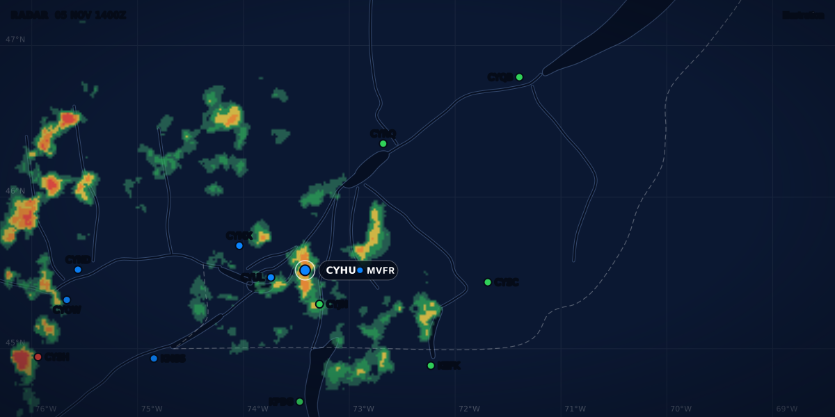
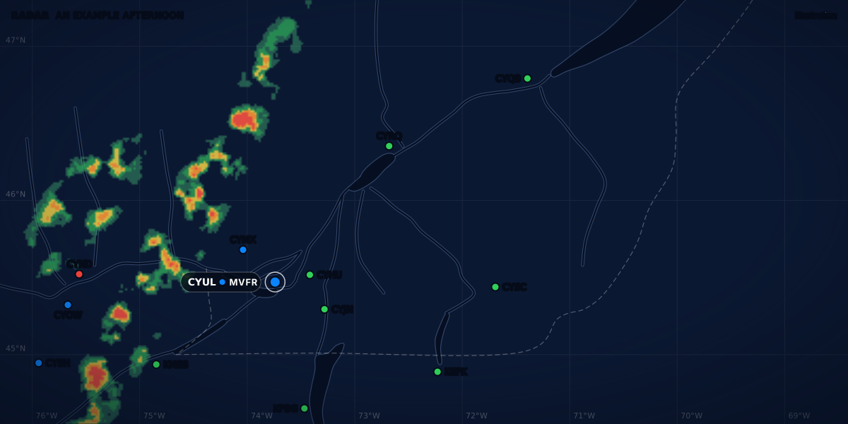
| Where is the rain now? | Radar. In convective weather, a radar or satellite image shows the situation only at the time on its label. It does not show how the weather will change (Météo-France, p. 15). |
| How will my aeroplane perform in this air? | The temperature and the altimeter setting give the density altitude. |
| What do I set on the altimeter? | The METAR’s altimeter setting: see QNH and 29.92. |
| My field has no METAR. What now? | The nearest stations and the area forecast. I fly from CSE4 and CSB3, two fields with no weather report of their own. The no-METAR guide shows how to fill the gap. |
A flight category (VFR, MVFR, IFR, LIFR) sums up the ceiling and the visibility in one word. The flight categories guide explains them. The category is a summary; the VFR weather minimums are the law.
A worked example: St-Hubert to Québec
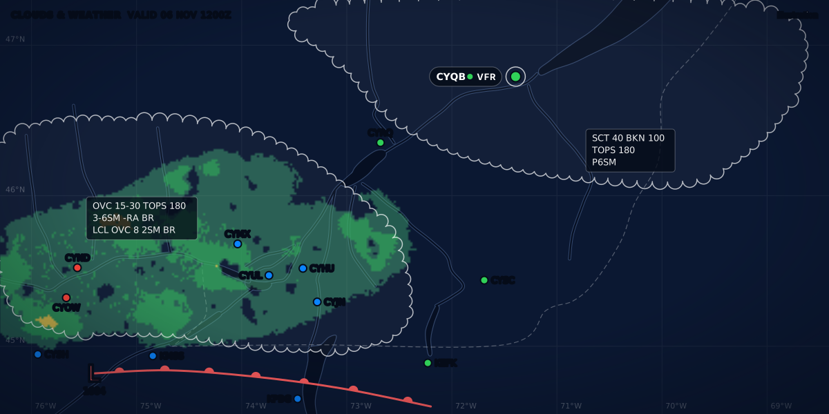
You plan a VFR flight from Montréal / St-Hubert (CYHU) to Québec / Jean Lesage (CYQB), leaving at 18:00 UTC on November 6. These two reports are a real-format example: they are constructed, not real reports.
METAR CYHU 061800Z 27012G20KT 15SM FEW035 SCT080 07/M01 A2995
METAR CYQB 061800Z 06012G22KT 4SM -RA BR OVC025 05/04 A2968
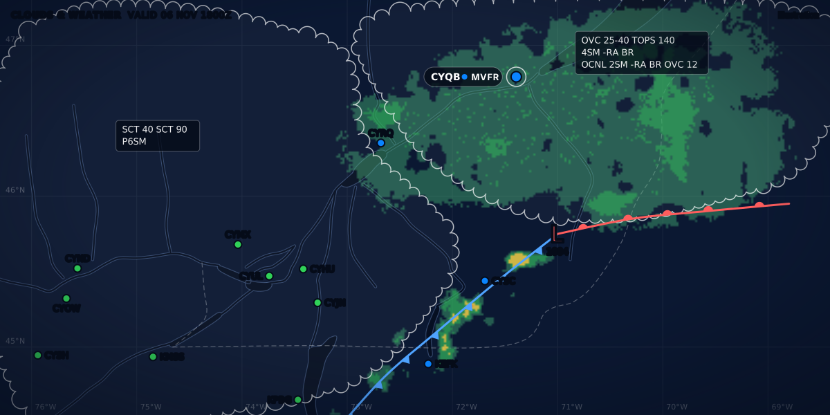
St-Hubert is VFR: 15 SM, no ceiling. Québec is MVFR: 4 SM in light rain and mist, with an overcast layer at 2,500 ft above the ground. The two reports say nothing about the air between the two airports. The Météo-France guide makes the same point: good weather at departure does not mean good weather along the route, and a list of METARs is not enough for a cross-country flight (p. 2).
So you add the other products, one question each:
- The TAF for CYQB. Will the rain and the low cloud stay until you arrive? The TAF guide decodes one group by group.
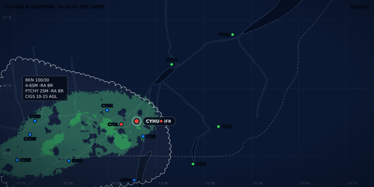
- The GFA valid at 18:00 UTC. GFA charts are valid at 00, 06, 12 and 18 UTC, and each issue comes out about 30 minutes before the start of its forecast period (TC AIM MET 4.2). The clouds and weather chart gives the cloud, the visibility and the weather between the two airports. It also draws the fronts and lows, with their speed and direction (TC AIM MET 4.11). Its cloud heights are above sea level. The second chart gives the icing, the turbulence and the freezing level.
- SIGMETs and AIRMETs. A SIGMET or an AIRMET amends the current GFA, so the GFA alone can be out of date (TC AIM MET 1.3.6).
- PIREPs and radar. Where the rain is now, and what pilots met in it.
- The FB for your cruising altitude. The wind changes your time en route and your fuel: see headwinds and cruise altitude.
What ClearMETAR shows, and what it does not
ClearMETAR covers the aerodrome layer of this map. It decodes METARs and SPECIs into plain words, draws the TAF as a timeline with the TEMPO and PROB groups in their own rows, and gives the flight category, the headwind and crosswind on the best runway end, and the density altitude. For a field with no report, it uses the nearest station’s weather and names that station. It does not show the GFA, SIGMETs, AIRMETs, PIREPs or winds aloft: for a Canadian airport it links to NAV CANADA’s site for NOTAMs and the GFA, and for a US airport to the FAA’s NOTAM search. The app says it too: its decoded text supports the official reports and does not replace them.
Sources
- TC AIM (TP 14371E) 2026-2, MET 1.1-1.3 (services, reports, forecasts, FB, radar), 4.1-4.4 and 4.11 (GFA), 5.1, 5.2 and 5.6 (AIRMET), 6.2, 6.6 and 6.15 (SIGMET), 7.2 (TAF), Transport Canada
- NWS Instruction 10-811, En Route Forecasts and Advisories (September 2, 2025), sections 2-5, 6.1-6.3 and 7, National Weather Service
- NWS Instruction 10-813, Terminal Aerodrome Forecasts (October 30, 2024), sections 1, 4, 4.2 and 4.10, National Weather Service
- Federal Meteorological Handbook No. 1 (FCM-H1-2019), 2.5.2 and 2.6.4, Office of the Federal Coordinator for Meteorology
- Service Change Notice 17-89: termination of the CONUS Aviation Area Forecast (effective October 10, 2017), National Weather Service
- Service Change Notice 24-92: retirement of the CONUS text AIRMET (on or about January 27, 2025), National Weather Service
- Service Change Notice 25-01: retirement of the Caribbean, Gulf and Hawaii area forecasts (January 27, 2025), National Weather Service
- Service Change Notice 26-47, updated November 5, 2026: termination of the NAM and its winds aloft (FB) headers (November 3, 2026), National Weather Service
- Service Change Notice 26-85: convective SIGMET changes (on or about December 1, 2026), National Weather Service
- GFA help: Graphical Forecasts for Aviation, NOAA Aviation Weather Center
- Aviation weather data help: METAR, PIREP, CWA, NOAA Aviation Weather Center
- Winds and temperatures aloft (notice: tables discontinued), NOAA Aviation Weather Center
- Guide aviation 2024, pp. 2-5 (products, Aéroweb, phone), 7-10 (TEMSI), 13 (WINTEM), 15 (radar), 16-17 (METAR), 20 (TAF), 23 (SIGMET), 25 (AIRMET), Météo-France
- AIC France A 06/22: SOFIA-Briefing in service (November 15, 2022), Service de l'Information Aéronautique
- Flight Service FAQ (800-WX-Brief), Leidos Flight Service
Rules checked on
Common questions
Which product covers my whole route?
No single product does: a METAR and a TAF cover one aerodrome (a Canadian TAF is for the area within 5 NM of the centre of the runway complex, TC AIM MET 7.2). For the route, read the area forecast (the GFA in Canada, TC AIM MET 4.1; the GFA tool in the US, AWC GFA help; TEMSI and WINTEM charts in France, Météo-France Guide aviation p. 2) with the SIGMETs, AIRMETs and PIREPs.
Does the US still issue area forecasts?
Only for Alaska (NWSI 10-811 section 5). The text area forecast ended for the lower 48 on October 10, 2017 (NWS SCN 17-89) and for the Caribbean, the Gulf and Hawaii on January 27, 2025 (SCN 25-01); the GFA tool on aviationweather.gov replaces it.
Which products does ClearMETAR show?
The aerodrome layer: decoded METARs and SPECIs, the TAF as a timeline, the flight category, the headwind and crosswind on the best runway end, the density altitude, and the nearest station's weather for a field with no report. It does not show the GFA, SIGMETs, AIRMETs, PIREPs or winds aloft.
Let the app do the decoding.
ClearMETAR turns every METAR and TAF into one plain sentence. Free on iPhone.