CLOUDS & WEATHER VALID 07 NOV 1200Z
Illustration
NAV CANADA weather on CFPS: how to brief now that AWWS is gone
AWWS is retired: NAV CANADA weather is on CFPS. What to open, in which order, how to call a FIC at 1-866-WXBRIEF, and a worked CYHU to CYQB briefing.
 Jp Valery
15 min read
NAV CANADA’s old Aviation Weather Web Site (AWWS) is gone. NAV CANADA decommissioned it effective February 28, 2024 (NAV CANADA, Flight planning and reporting). Its weather, NOTAMs and flight plans now live on CFPS, the Collaborative Flight Planning Services site at plan.navcanada.ca.
In Canada you brief in two ways. You read the products on CFPS yourself, or you call a flight information centre (FIC) at 1-866-WXBRIEF. This guide is the Canadian part of how to get a weather briefing. It shows what to open on CFPS and in which order, what to tell the FIC, and a briefing built from one night’s real data for a flight from St-Hubert to Québec City.
AWWS is gone: where its pages went
NAV CANADA says that everything AWWS offered “can now be accessed through” CFPS and the Flight Planning page of NC-Spaces, another NAV CANADA site. The TC AIM now names CFPS as NAV CANADA’s aviation weather website: it “offers aviation weather products, NOTAM and the ability to file flight plans” (TC AIM MET 1.1.3). If a bookmark or an old handout still says AWWS, use CFPS.
The CFPS menu has two weather tabs: Weather and NOTAM, and GFA. The Weather and NOTAM tab “does not require a login” (NAV CANADA). In November 2026, the GFA tab opened without an account too.
| You want | Where it is now |
|---|---|
| METAR and SPECI, TAF, AIRMET, SIGMET, PIREP, upper winds, NOTAM | CFPS, Weather and NOTAM tab |
| Radar, satellite, analysis and significant weather charts | CFPS, Weather and NOTAM tab |
| The graphic area forecast (GFA) for each region | CFPS, GFA tab |
| NAV CANADA weather cameras | CFPS home page, Links: “Canadian Cameras” |
| US weather and US cameras | CFPS home page, Links: “USA Weather” (aviationweather.gov) and “USA Cameras” |
| File, change, delay or cancel a flight plan | CFPS, from its Sign In page (“Manage your flight plans online”), or a FIC by phone |
| A weather briefer | A FIC: 1-866-WXBRIEF, 24 hours |
NAV CANADA’s Aviation Weather Services Guide (revised May 2026) gives the full list of the Weather and NOTAM tab: SIGMET, AIRMET, NOTAM, METAR and SPECI, TAF, PIREP, Upper Wind, Space Weather, BC VFR Route Forecast, Analysis charts, Radars, Satellites, Graphical Forecast, Significant Weather, Turbulence chart and Wind charts. The GFA tab gives access to all the GFA regions (pp. 2-3).
Search by place, not by product. Weather and NOTAMs on CFPS are geographically referenced. You enter a point, such as an aerodrome, a NAVAID or a flight information region, with an optional radius around it. CFPS returns every Canadian NOTAM whose radius of influence covers your entry, and the weather for every aerodrome inside it. You can also enter a route: you get the selected weather and the NOTAMs that cross it. One trap: a NAVAID entry searches its location only. It does not find NOTAMs about that NAVAID (NAV CANADA).
Two ways to brief in Canada
The law asks you to know the weather, not to call anyone. Before a flight, the pilot-in-command “shall … be familiar with the available weather information that is appropriate to the intended flight” (CARs 602.72). CARs 602.71 says the same about “the available information” in general. Neither rule names a source or a phone call. The briefing guide compares this rule with the US and European ones.
| Self-briefing on CFPS | FIC briefing | |
|---|---|---|
| What you get | The products, as issued | A briefing by a flight service specialist, who can “interpret meteorological information” (TC AIM MET 1.1.3) |
| Best for | The general picture, before a call | Complex or fast-changing weather |
| Flight plan | Online, from the CFPS Sign In page | By phone, at the end of the briefing |
You can also do both. NAV CANADA writes that “a common practice amongst many pilots is to use the NAV CANADA CFPS to get an appreciation of general weather conditions prior to contacting the FIC for a briefing”. It adds that most pilots find a briefer “particularly beneficial when facing complex or rapidly changing weather conditions” (Aviation Weather Services Guide, pp. 3 and 5).
Self-briefing on CFPS: what to open, in order
Two rules from TC AIM MET 1.2.2 frame the job. You must use the most recent weather information and know when the next scheduled update comes. You must also watch for unscheduled updates and amendments. The same section lists what to review: “the relevant GFAs, AIRMETs, SIGMETs, TAFs, METARs, SPECIs, PIREPs and upper wind and temperature forecasts”, then satellite, radar and lightning “as available”. NAV CANADA’s advice is to start with “the big weather picture” (Aviation Weather Services Guide, p. 5). So the list below starts with the region, then the aerodromes, then the rest:
- GFA (GFA tab). Open the region that covers your route, for example GFACN33, Ontario – Quebec. Read the clouds and weather chart and the icing, turbulence and freezing level chart for the times before and after your flight, and the IFR outlook. GFA heights are above sea level unless the chart says otherwise (MET 1.2.2). The GFA guide reads a chart panel by panel.
- AIRMET and SIGMET. Once issued, each one “automatically amends the current and relevant GFA” (MET 1.3.6). Check the area, the levels and the valid time. AIRMET vs SIGMET decodes both.
- TAF for the departure, the destination and every alternate, over your whole time window. A TAF exists only where the aerodrome has METAR and SPECI reports (MET 1.3.3). How to read a TAF covers every group.
- METAR and SPECI. They tell you whether the TAF is right so far. How to read a METAR covers every group.
- PIREP. Pilots report what no station sees, such as cloud tops, upper cloud layers and the wind at cruising level (MET 1.1.6.1). Their heights are normally above sea level too (MET 1.2.2). See how to read a PIREP.
- Upper Wind (the FB forecasts). The direction is in degrees true (MET 9.2). CFPS “may display this information differently” from the original code, and a FIC can help you read it (MET 9.2). See how to read winds aloft.
- Radars and Satellites. Radar shows precipitation, usually within 150 NM of each site, and the images update about every 10 minutes. It “cannot detect turbulence” (MET 1.3.9.1), and it does not show cloud cover (Aviation Weather Services Guide, p. 25). CFPS carries visible and infrared satellite images (same guide, p. 26).
- Lightning. Detailed real-time data from the Canadian Lightning Detection Network goes to the FICs, which can describe it to you (MET 1.3.9.2).
- Weather cameras (Links, “Canadian Cameras”). A WxCam sends a still image to CFPS every 10 minutes. Most sites have four camera angles, with reference images (MET 1.2.3(e)).
- NOTAMs, last. See the NOTAM section below.
No report at your field? I fly from two fields with no weather report, CSE4 and CSB3. For a field like that, steps 3 and 4 have nothing to show at the field itself. Weather without a METAR covers the nearest station and how far to trust it.
Calling a FIC: numbers and hours
All FICs provide 24-hour service (TC AIM MET 1.3.1).
| Number | Where the call goes | Source |
|---|---|---|
| 1-866-WXBRIEF (1-866-992-7433) | The FIC that serves the area you call from | MET 1.3.1, RAC 3.2 |
| 1-866-GOMÉTÉO (1-866-466-3836) | The Québec FIC, for bilingual service | TC AIM RAC 3.2 |
| 1-866-541-4101 | Kamloops FIC | NAV CANADA |
| 1-866-541-4102 | Edmonton FIC | NAV CANADA |
| 1-866-541-4104 | London FIC | NAV CANADA |
| 1-866-541-4105 | Québec FIC (bilingual service) | NAV CANADA |
- The two named numbers are toll-free within Canada only. The four direct numbers reach a specific FIC from Canada and from the continental United States (Aviation Weather Services Guide, pp. 4-5). NAV CANADA gives them for two cases: you cannot reach the right FIC, or you call from the United States.
- “Collect calls from pilots are accepted at all FICs” (RAC 3.2).
- The Canada Flight Supplement (CFS) and the Canada Water Aerodrome Supplement (CWAS) list every FIC number, in the General section and in the Aerodrome/Facility Directory (RAC 3.2, 3.3; names from TC AIM GEN 5.2). Take your numbers from the TC AIM, the CFS or navcanada.ca, not from an old web page.
- In flight, call a FIC on a flight information service en route (FISE) frequency when you need weather to decide, to end the flight or to change course before you meet bad weather. Avoid asking for a first briefing in the air: the TC AIM says this “leads to frequency congestion” (MET 1.1.4).
What to tell the specialist
The specialist uses your answers to tailor the briefing (RAC 3.2). NAV CANADA also suggests four things before you dial: a pen and paper, a look at the general weather, your questions, and the details of your flight (Aviation Weather Services Guide, p. 5). If you are a new pilot or new to the area, say so (p. 6).
- Pen and paper
- The general picture from CFPS: the GFA for your region
- Your questions for the briefer
- What you already have, with times
- That you are a pilot, and your aircraft identification
- Initial or update briefing (if an update: the time of the last one)
- Type of flight: VFR, IFR, CVFR or composite
- Type of aircraft
- Departure aerodrome and ETD
- Destination and estimated elapsed time (EET)
- Planned cruising altitude(s)
- Route, and times at any intermediate stop
- Alternate aerodrome, if appropriate
- Briefing or consultation
- Information already on hand
- New pilot, or new to the area: say so
The “Tell the specialist” list is RAC 3.2: who you are and the aircraft identification, then items (a) to (i). Two items come from NAV CANADA’s guide: initial or update (p. 5), and new to the area (p. 6).
The order of a FIC briefing
The briefer “normally follows a prescribed format and sequence” (Aviation Weather Services Guide, p. 6):
- Significant meteorological and aeronautical information
- Description of major weather features
- Forecast weather summary
- Route winds and temperatures
- Detailed weather information
- Supplementary aeronautical information, such as NOTAMs
- Briefing review and updates
- PIREP request
- Flight plan, if required
The specialist may skip what you already have, or keep to what you asked for. The briefing ends with a request for any flight plan information still missing, and for a PIREP if appropriate (RAC 3.2). Ask when something is unclear: “if you don’t ask questions, the briefer will assume that you have understood everything” (Aviation Weather Services Guide, p. 6). And the decision stays yours: the briefer gives the information, but “the responsibility for proceeding with the flight rests solely with you” (same page).
NOTAMs
Before a flight, “pilots must ensure that each pertinent NOTAM series and type has been reviewed” (TC AIM RAC 3.3). A FIC gives NOTAMs routinely during a briefing (RAC 3.3). All Canadian NOTAMs except RSC NOTAMs use the ICAO format (RAC 3.3). Since October 10, 2019, they are no longer tied to an aerodrome NOTAM file (NAV CANADA).
- On CFPS, the Weather and NOTAM tab finds NOTAMs by place: around a point, or along a route. Remember the NAVAID trap above.
- On NC-Spaces, since May 2026, you can search NOTAMs by departure, flyover, destination and alternate aerodromes, with a radius around the route, and read them as a list by category or on a map (NAV CANADA).
Worked example: VFR from St-Hubert to Québec City
This briefing uses real data, read at about 0330Z on 7 November 2026, about 22:30 EST on 6 November in Montréal. That is the evening before the flight: NAV CANADA suggests you start to watch the weather “a day or so prior” (Aviation Weather Services Guide, p. 6). The METARs and TAFs come from aviationweather.gov, and CFPS showed the same CYHU and CYQB reports. The SIGMET, the PIREP search and the upper winds come from CFPS.
| The plan | |
|---|---|
| Flight | VFR, Montréal / St-Hubert (CYHU) to Québec / Jean Lesage (CYQB) |
| Distance | 113.7 NM, initial course 047° true (computed) |
| ETD | 1400Z on 7 November (09:00 EST) |
| EET | 1 h 8 min at a sample ground speed of 100 kt (computed) |
| ETA | 1508Z, so an arrival window of 1408Z to 1608Z with 1 h either side |
| Possible stop | Trois-Rivières (CYRQ), 58.9 NM from CYHU (computed) |
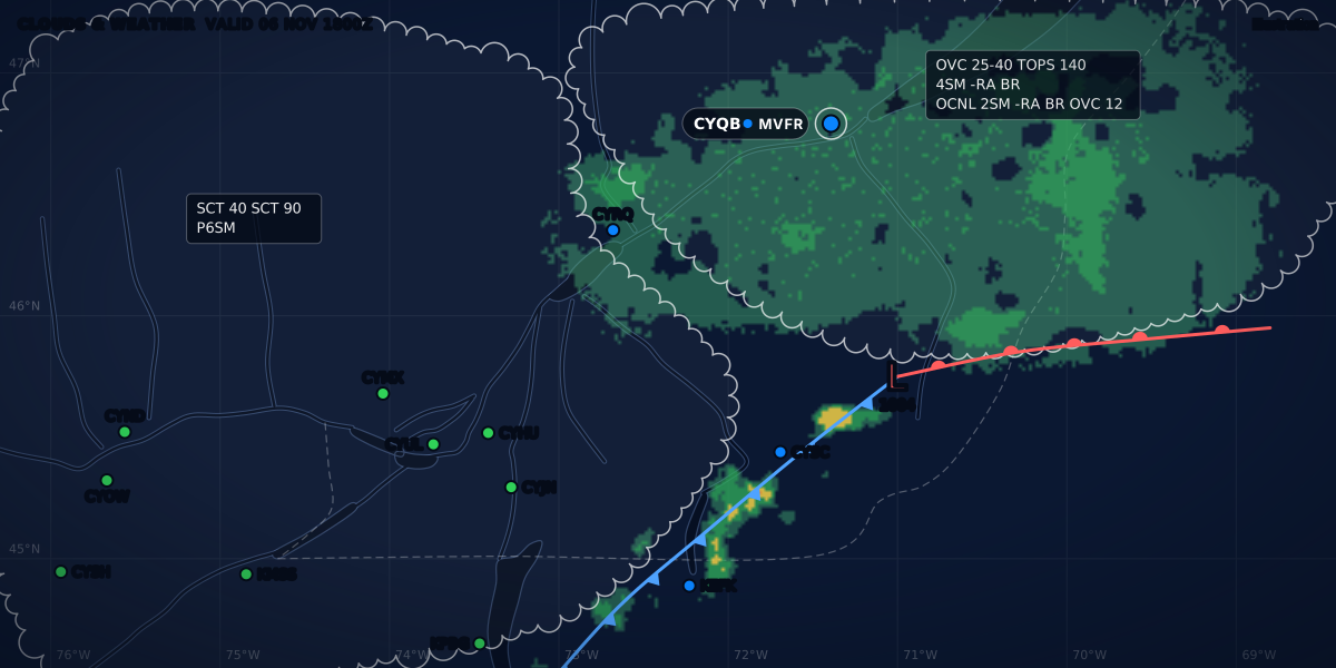
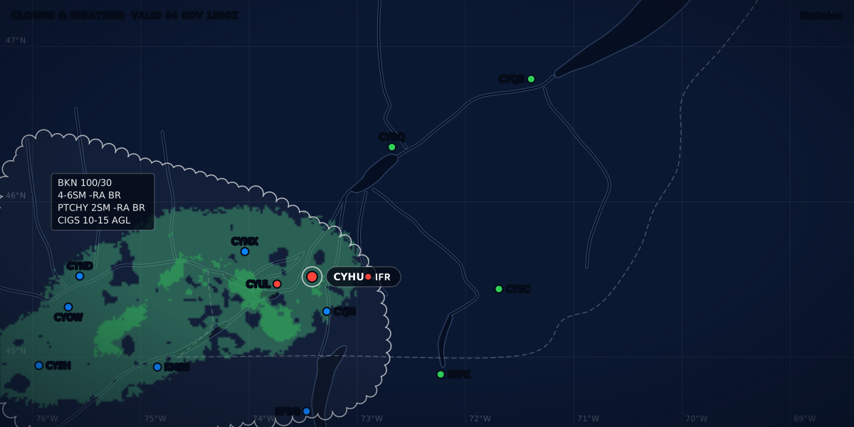
1. GFA. At 0330Z, the current GFACN33 was the issue of about 2330Z. It has charts valid at 0000Z, 0600Z and 1200Z, and an IFR outlook from 1200Z to 0000Z (computed from TC AIM MET 4.2). For a flight from 1400Z to 1508Z, you read the 1200Z charts and the IFR outlook. The issue of about 0530Z adds charts at 1800Z: with the 1200Z charts, they bracket the flight. This page does not reproduce NAV CANADA’s charts: any map on it is an illustration.
2. AIRMET and SIGMET. No AIRMET came back for CYHU. One SIGMET did:
CZUL SIGMET Y1 VALID 070245/070645 CWUL-
CZUL MONTREAL FIR SEV TURB OBS WI 60NM WID LINE BTN /N4525 W07315/20 E CYUL -
/N4739 W07053/45 S CYBG - /N4944 W06554/30 SE CYZV FL280/350 MOV NE 25KT NC
RMK GFACN34 GFACN33=
It warns of severe turbulence (SEV TURB, MET 6.2) from FL280 to FL350, within a 60 NM wide line that starts 20 NM east of Montréal (CYUL) and runs northeast. CYHU, CYRQ and CYQB are all within 15 NM of its centre line (computed). The line moves northeast at 25 kt with no change in intensity (NC, MET 6.9, 6.10). The remark names the GFA regions it amends, GFACN34 and GFACN33 (MET 4.13, 6.11). FL280 is far above a VFR flight in a light aircraft, and the SIGMET was valid until 0645Z, 7 h 15 min before the ETD (computed): a SIGMET is valid for 4 hours (MET 6.6). In the morning, look for the next one. AIRMET vs SIGMET decodes the rest.
3. TAFs. Here is the destination, with the arrival window drawn on the timeline:
From 0400Z the forecast is a broken layer at 1,500 ft and wind from 070° at 15 kt gusting to 30. A TEMPO group lifts the ceiling to 3,000 ft at times until 1600Z. From 1600Z it is overcast at 1,500 ft, with wind from 070° at 18 kt gusting to 28. The departure TAF, one group per line:
TAF CYHU 062340Z 0700/0724 03012G22KT P6SM SCT030 BKN080
  TEMPO 0700/0706 BKN020 OVC080
  FM070600 03015G25KT P6SM BKN020 BKN080
  TEMPO 0706/0715 SCT020 OVC080
  FM071500 03015G25KT P6SM OVC015
  TEMPO 0715/0718 P6SM -RA
  FM071800 03015G25KT 6SM -RA BR OVC015
  TEMPO 0718/0724 4SM -RA BR FEW008 OVC012
  BECMG 0722/0724 03015KT
  RMK FCST BASED ON AUTO OBS. NXT FCST BY 070600Z
At the 1400Z departure, St-Hubert is forecast to have a broken layer at 2,000 ft and wind from 030° at 15 kt gusting to 25. At times until 1500Z, that layer is only scattered, under an overcast at 8,000 ft. From 1500Z the cloud comes down to an overcast layer at 1,500 ft. The Trois-Rivières TAF (TAF CYRQ 070140Z 0702/0714) was valid only until 1400Z, so it said nothing about the time you would pass there. Both TAFs above end with NXT FCST BY 070600Z: the next regular TAF would be issued at 0600Z (MET 7.3).
4. METARs. At 0300Z, both ends were fine:
METAR CYHU 070300Z AUTO 03009G17KT 9SM OVC091 09/05 A2994 RMK SLP143
METAR CYQB 070300Z 07016KT 15SM OVC035 09/04 A2998 RMK SC8 SLP155
The ceilings were 9,100 ft and 3,500 ft: both VFR. The low cloud is in the forecast, not yet in the reports. A METAR is the past, and the TAF says what comes next.
ClearMETAR shows these same METARs and TAFs, with the TAF on a strip you can drag hour by hour. Its data comes from the NOAA Aviation Weather Center. For a Canadian airport, its station screen has a “NOTAMs and GFA” link that opens CFPS, and the app is also in French. It does not replace CFPS or a FIC briefing.
5. PIREPs. The CFPS search around CYHU, CYRQ and CYQB returned none. No PIREP does not mean no turbulence or icing.
6. Upper winds. The FBCN33 forecast, valid at 1200Z for use from 0900Z to 1800Z, as CFPS listed it:
| Level | YUL (Montréal) | YQB (Québec) |
|---|---|---|
| 3,000 ft | 070° true, 13 kt | 080° true, 26 kt |
| 6,000 ft | 050° true, 7 kt, +2 °C | 100° true, 9 kt, +2 °C |
At 3,000 ft, the wind near Québec was twice the wind near Montréal: 26 kt from 080° against 13 kt from 070°. No temperature is forecast at 3,000 ft (MET 9.2).
7. Radar, satellite, cameras and NOTAMs. Read these on the morning of the flight, close to the ETD. They change too fast to copy here, and an old NOTAM list can mislead.
The decision. Compare the forecast with your limits, not only with the category. The 2,000 ft at CYHU and the 1,500 ft at CYQB make both ends MVFR. A flight category is a summary, and the minimums are the law. The sample personal minimums of the personal minimums guide are a 3,000 ft ceiling, 5 SM and a 10 kt crosswind. Both forecast ceilings are below that 3,000 ft, by 1,000 ft and 1,500 ft (computed). The gusts at CYQB reach 30 kt. With these sample limits, the flight was a no-go as forecast that evening. The next step was to brief again after the new TAFs, close to the ETD, and to call a FIC with the same list: you already have the TAFs, METARs and SIGMET, so the specialist can focus on what changed.
Flying to the US
- Near the border, the TC AIM says US METAR, SPECI and TAF “must be obtained” through aviationweather.gov (MET 1.1.3). CFPS links to it (“USA Weather”), and to the FAA weather cameras (“USA Cameras”).
- A Canadian briefer gives you the US weather they have. NAV CANADA still encourages you to call a US flight service for an update briefing as soon as possible after you enter the US (Aviation Weather Services Guide, p. 6). The US Flight Service number is 800-WX-Brief (800-992-7433) (1800wxbrief.com).
- If you call a Canadian FIC from the US, the briefer can give you the weather for the Canadian part of your return only (same guide, p. 6). Use a direct FIC number from the table above.
- Flight plans work differently. In Canada, if no extension or cancellation reaches the responsible ATS unit by the proposed departure time, that unit activates your VFR flight plan with the ETD as the departure time (TC AIM RAC 3.5.4). NAV CANADA warns that in the US, a filed VFR flight plan opens only when you activate it yourself (Aviation Weather Services Guide, p. 6).
- US products differ from Canadian ones. For example, the US GFA is an interactive map, not a set of charts: see the US section of the GFA guide.
Next: read the GFA panel by panel, or go back to the full briefing method.
Sources
- Flight planning and reporting: CFPS, the AWWS decommissioning, NC-Spaces NOTAMs and FIC telephone numbers, NAV CANADA
- Aviation Weather Services Guide (revised May 2026): CFPS, FICs, weather briefing tips, pilot briefing format, trans-border flights, NAV CANADA
- Collaborative Flight Planning Services (CFPS): home page, Weather and NOTAM, GFA, NAV CANADA
- TC AIM (TP 14371E) 2026-2, MET 1.1.3, 1.1.4, 1.1.6.1, 1.2.2, 1.2.3, 1.3.1, 1.3.3, 1.3.6, 1.3.9, 4.2, 4.13, 6.2-6.11, 7.3 and 9.2, Transport Canada
- TC AIM (TP 14371E) 2026-2, RAC 3.2 (pilot briefing service), 3.3 (aeronautical information) and 3.5.4, Transport Canada
- TC AIM (TP 14371E) 2026-2, GEN 5.2: abbreviations and acronyms, Transport Canada
- CARs 602.71 (pre-flight information) and 602.72 (weather information), Justice Laws Website
- Flight Service: 800-WX-Brief, 1800wxbrief.com
Rules checked on
Common questions
What replaced AWWS?
CFPS, NAV CANADA's Collaborative Flight Planning Services site at plan.navcanada.ca. NAV CANADA decommissioned AWWS effective February 28, 2024, and says all its features are now on CFPS and the Flight Planning page of NC-Spaces (NAV CANADA, Flight planning and reporting).
What number do I call for a weather briefing in Canada?
1-866-WXBRIEF (1-866-992-7433): the call goes to the flight information centre (FIC) that serves the area you call from (TC AIM MET 1.3.1, RAC 3.2). From the United States, or if you cannot reach the right FIC, NAV CANADA lists four direct numbers, such as 1-866-541-4105 for the Québec FIC.
Can I get a weather briefing in French?
Yes. A call to 1-866-GOMÉTÉO (1-866-466-3836) goes to the Québec FIC, which provides bilingual service (TC AIM RAC 3.2).
Is the FIC open 24 hours?
Yes: "All FICs provide 24-hr service" (TC AIM MET 1.3.1). The common number, 1-866-WXBRIEF, routes your call to the FIC for your area.
Let the app do the decoding.
ClearMETAR turns every METAR and TAF into one plain sentence. Free on iPhone.