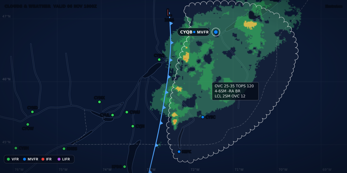
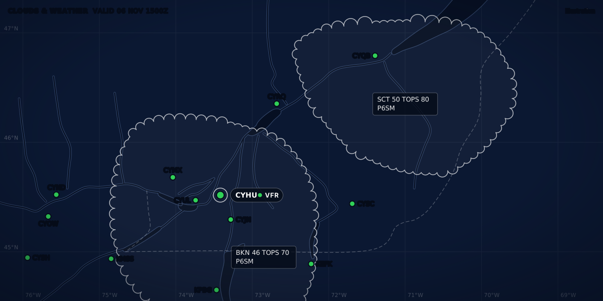
CLOUDS & WEATHER VALID 03 NOV 1800Z
Illustration
QNH, QFE and 29.92: altimeter settings in Canada, the US and Europe
QNH, QFE, A2992 and Q1013 explained, with the rules: the altimeter-setting region and 18,000 ft in Canada and the US, the transition altitude in Europe.
 Jp Valery
15 min read
Your altimeter measures air pressure and shows it as a height. The number you set on its subscale decides what that height means: your altitude above sea level, your height above the runway, or a flight level. This guide explains the three settings, how a METAR gives you the first one, and when the rules in Canada, the US and Europe make you change from one to another. It is part of our series on aviation weather products.
| Setting | With it set, the altimeter shows | Where you get it |
|---|---|---|
| QNH (the altimeter setting) | Your altitude above sea level | The METAR (A2950 in Canada and the US, Q1023 in France), the ATIS, ATC |
| QFE | Your height above the aerodrome | In France: the ATIS, ATC on request |
| Standard pressure: 29.92 inHg or 1013.2 hPa | A flight level | Nothing to get: it never changes |
The middle column follows the glossary of Météo-France’s Guide aviation 2024 (p. 30): an altimeter set to the QNH shows the altitude, set to the QFE it shows the height above the QFE reference, and set to 1013.2 hPa it can show the flight level.
QNH, QFE and standard pressure
QNH. Météo-France defines the QNH as the pressure reduced to sea level by calculation, in the conditions of the standard atmosphere (p. 30). Canadian and US documents call it the altimeter setting. The US Federal Meteorological Handbook No. 1 (FMH-1) defines it by what it does: the value to set on the altimeter so that it shows the altitude above mean sea level of an aircraft on the ground at the place of the measurement (11.3(b)).
So on the ground, with the current setting, your altimeter should read the field elevation. The TC AIM gives the tolerance in AIR 1.5.1: no more than ±50 ft against a known aerodrome or runway elevation. With a larger error, have the altimeter checked by maintenance.
Altimeters are calibrated in the ICAO Standard Atmosphere: dry air, 29.92 inHg and 15 °C at sea level, and a temperature that falls by 1.98 °C per 1,000 ft (TC AIM AIR 1.5.2).
QFE. Météo-France defines it as the pressure computed for the highest point of the aerodrome’s landing area. The altitude of that point is also the official aerodrome elevation (p. 30). With the QFE set, the altimeter shows your height above that point, so it reads about 0 on the runway. In France, the ATIS and the air traffic services give the QNH and the QFE (p. 6), and ATC gives the QFE on request (AIP France ENR 1.7, 1.7.2.3). The Canadian and US rules below name only the altimeter setting of an aerodrome or station, the aerodrome elevation and 29.92 inHg (1013.2 mb in the CARs).
A computed example, with the standard atmosphere: at a field 1,000 ft above sea level, on a day with a QNH of 1013 hPa, the QFE is about 977 hPa. On the runway, the altimeter shows 1,000 ft with the QNH set and 0 ft with the QFE set.
Standard pressure. It is a fixed value: 29.92 inHg, or 1013.2 hPa. The Canadian Aviation Regulations define a flight level as the altitude in hundreds of feet shown by an altimeter set to 29.92 inHg or 1013.2 mb (CARs 101.01). 14 CFR 1.1 gives the same reference: FL250 is an altimeter reading of 25,000 ft. In France, flight level zero is the 1013.2 hPa pressure surface, and flight levels are 500 ft apart (AIP France ENR 1.7.2.1).
With standard pressure set, the altimeter shows the pressure altitude (TC AIM AIR 1.5.4): the height of your pressure level in the standard atmosphere, above the 1013.25 hPa surface (Météo-France, p. 28). Pressure altitude is the first step to density altitude.
What A2992 and Q1013 mean in a METAR
Here is a real-format example (constructed, not an observation) from Québec City. It is the destination of the worked example further down.
A2950 is the altimeter setting. The A marks inches of mercury, and the four digits are the tens, units, tenths and hundredths. Put a decimal point after the second digit: 29.50 inHg (TC AIM MET 8.2; FMH-1 12.6.11). Canada and the US both use this group. A2992 is 29.92 inHg, standard pressure.
A French METAR, the European example in this guide, gives the QNH in hectopascals. This is a real report from Paris–Charles de Gaulle (LFPG), November 6, 2026 at 20:00 UTC (NOAA Aviation Weather Center):
Q1023 is a QNH of 1023 hPa. Météo-France’s decoding table says the group is the QNH rounded down to the whole hectopascal (p. 17). So Q1013 means a QNH from 1013.0 to just under 1014 hPa, and standard pressure (1013.2 hPa) is in that range.
US and French values are rounded down. FMH-1 11.5.1 rounds a US altimeter setting down to the hundredth: 29.248 inHg is reported as 29.24. In France, ATC also rounds the QNH and QFE it gives down to the whole hectopascal (AIP France ENR 1.7.2.4). A setting that is a little low makes the altimeter read a little low, so you are a little higher than it shows (TC AIM AIR 1.5.3). Near sea level, the most that rounding can hide is about 9 ft for 0.01 inHg and 27 ft for 1 hPa (computed below).
The remarks of a METAR often carry a second pressure, SLP. It is not the altimeter setting: the section on SLP below shows why.
inHg and hPa
A hectopascal is the same unit as a millibar. The NWS pressure conversion sheet gives the factors:
hPa  = 33.8639 × inHg
inHg = 0.0295300 × hPa
Computed with those factors:
| METAR group | inHg | hPa |
|---|---|---|
A2850 |
28.50 | 965.1 |
A2900 |
29.00 | 982.1 |
A2950 |
29.50 | 999.0 |
A2992 |
29.92 | 1013.2 |
A3000 |
30.00 | 1015.9 |
A3050 |
30.50 | 1032.8 |
A3100 |
31.00 | 1049.8 |
Q0980 |
28.94 | 980 |
Q1000 |
29.53 | 1000 |
Q1013 |
29.91 | 1013 |
Q1023 |
30.21 | 1023 |
Q1030 |
30.42 | 1030 |
Q1040 |
30.71 | 1040 |
How much does a wrong setting move the altimeter? Near sea level, 1 hPa is about 27 ft and 0.01 inHg is about 9 ft. These come from the NWS pressure altitude formula. TC AIM AIR 1.5.3 uses a round figure: 1,000 ft of indicated altitude for each inch of mercury, so 10 ft per 0.01 inHg.
The ClearMETAR app shows the altimeter setting in the unit you choose, inHg or hPa, with the other unit next to it. It starts with inHg when your device’s region is the US or Canada, and with hPa elsewhere. You can change it in Settings.
The rules side by side
| Canada | United States | France (Europe) | |
|---|---|---|---|
| Rule | CARs 602.35 to 602.37; TC AIM RAC 2.10, 2.11 | 14 CFR 91.121 | AIP France ENR 1.7 |
| Where you fly on the local setting | The altimeter-setting region: below 18,000 ft ASL, in the Southern Domestic Airspace | Below 18,000 ft MSL | At or below the transition altitude |
| Which local setting | The nearest station along the route; if those stations are more than 150 NM apart, a station near the route | A station along the route within 100 NM of the aircraft; if there is none, an appropriate available station | The QNH from the ATIS or ATC |
| Where you fly on 29.92 or 1013.2 | The standard pressure region: 18,000 ft ASL and above, and every height in the north | 18,000 ft MSL and above | Above the transition altitude, in flight levels |
| When you change, climbing | Immediately after you enter the standard pressure region | 91.121 sets the setting by height, not by a moment | At the latest when you cross the transition altitude |
| When you change, descending | Immediately before you enter the altimeter-setting region | Same as climbing | At the latest when you cross the transition level |
Canada and the US switch at one height everywhere: 18,000 ft. France switches at a transition altitude set for each terminal control area. Canada adds one more line: a lateral one, in the north.
Canada: altimeter-setting region and standard pressure region
The CARs 101.01 define the altimeter setting region as “the low level airspace so specified, and delineated, in the Designated Airspace Handbook”. The standard pressure region is all the rest of Canadian domestic airspace. The Designated Airspace Handbook (DAH, Issue 324, glossary) then makes it concrete:
- The altimeter setting region is all low level airspace within the Southern Domestic Airspace (SDA).
- Low level airspace is all airspace below 18,000 ft ASL.
- So the standard pressure region is everything at or above 18,000 ft ASL, plus all the low level airspace north of the SDA boundary. The DAH map M3 shows the two regions.
TC AIM RAC 2.11 says the same thing in one sentence: the standard pressure region includes all airspace over Canada at or above 18,000 ft ASL, and all low-level airspace outside the lateral limit of the altimeter setting region. In the north, you cruise on 29.92 at any height, and the aerodrome’s setting is only for takeoff and landing (CARs 602.36, below). There, heights are flight levels: FL 50 is an altimeter indication of 5,000 ft (TC AIM RAC 2.11, note).
In the altimeter-setting region
CARs 602.35 and TC AIM RAC 2.10 give three steps:
- Before takeoff: the aerodrome’s altimeter setting. If you cannot get it, set the aerodrome elevation.
- In flight: the setting of the nearest station along the route. If the nearest stations along the route are more than 150 NM apart, use a station near the route.
- Before you start a descent to land: the aerodrome’s setting, if you can get it.
The two fields I fly from, CSE4 and CSB3, have no weather report. At a field like that, step 1 lets you set the field elevation. Our guide to flying from a field without a METAR covers the nearest station and how far to trust it.
In the standard pressure region
- Before takeoff: the aerodrome’s altimeter setting, or its elevation.
- Before you reach your cruising flight level: 29.92 inHg or 1013.2 mb. If you cruise above FL180, TC AIM RAC 2.11(b) accepts the change at 18,000 ft ASL.
- Before you start a descent to land: the aerodrome’s setting, if you can get it. If you hold before landing, set the aerodrome’s setting immediately before you descend below the lowest flight level of the hold (602.36(2)).
Between the regions
CARs 602.37, unless ATC authorizes otherwise:
- Climbing into the standard pressure region: set 29.92 inHg or 1013.2 mb immediately after you enter it.
- Descending into the altimeter-setting region: set the setting of the nearest station along the route, immediately before you enter it. If those stations are more than 150 NM apart, use a station near the route.
TC AIM RAC 2.11(d) adds that ATC normally gives you the setting in the clearance before the descent. If it does not, ask for it.
United States: 91.121 and the lowest usable flight level
14 CFR 91.121(a) says which setting you use to hold your cruising altitude or flight level:
- Below 18,000 ft MSL: the current reported setting of a station along the route and within 100 NM of the aircraft. If no station is in that area, the current setting of an appropriate available station. Without a radio: the elevation of the departure airport, or an appropriate setting available before departure.
- At or above 18,000 ft MSL: 29.92 inHg.
The distance differs from Canada’s: 100 NM from the aircraft in the US, 150 NM between stations in Canada.
When the pressure is low, 91.121(b) raises the lowest flight level you can use:
| Current altimeter setting | Lowest usable flight level |
|---|---|
| 29.92 or higher | FL180 |
| 29.91 to 29.42 | FL185 |
| 29.41 to 28.92 | FL190 |
| 28.91 to 28.42 | FL195 |
| 28.41 to 27.92 | FL200 |
| 27.91 to 27.42 | FL205 |
| 27.41 to 26.92 | FL210 |
91.121(c) uses the same bands to turn a minimum altitude into a minimum flight level: add 500 ft for 29.91 to 29.42, 1,000 ft for 29.41 to 28.92, and so on up to 3,000 ft.
Europe: transition altitude and transition level
France, the European example in this guide, uses the same two settings, QNH below and 1013.2 hPa above. But the switch height changes from place to place. AIP France ENR 1.7 (1.7.2.3):
- Transition altitude: the altitude at or below which an aircraft’s vertical position is given as an altitude. There is one for each terminal control area (TMA). It is never less than 1,500 ft above the aerodrome.
- On the VFR chart: the 1:1,000,000 chart shows the transition altitude when it is not 5,000 ft.
- Transition level: the lowest flight level you can use above the transition altitude. It is at least 1,000 ft above the transition altitude. The air traffic services set it from the QNH reports and the forecast pressure.
- When you change: at the latest when you cross the transition altitude in a climb, and the transition level in a descent.
En route in France, you give your cruising level as a flight level above the transition altitude, and as an altitude below the lowest usable flight level (AIP France ENR 1.7.2.2). Our guide to VFR cruising altitudes gives the levels for each direction.
SLP is not the altimeter setting
Canadian METARs carry a sea-level pressure remark, SLP, in hectopascals (TC AIM MET 8.2), and so do the METARs of designated US stations (FMH-1 11.5.4 and Table 11-1). TC AIM MET 8.2 is clear: “SLP does not directly relate to altimeter setting, as the SLP is based upon actual temperatures, while the altimeter setting is based upon the ICAO standard atmosphere.” In the US, a station reduces its pressure to sea level with the station elevation and the 12-hour mean temperature: the average of the temperature now and 12 hours ago (FMH-1 11.4.4).
Three real reports from about the same time, November 6, 2026 (NOAA Aviation Weather Center):
METAR CYUL 062000Z 01003KT 350V070 30SM SCT062 BKN078 BKN250 17/09 A2987 RMK SC3AC4CI1 CI TR SLP117 DENSITY ALT 400FT
METAR CYYC 062000Z 19003KT 170V240 40SM FEW050 FEW160 BKN250 12/M03 A2974 RMK SC1AC1CI6 SC TR SLP098 DENSITY ALT 4400FT
METAR KDEN 061953Z VRB03KT 10SM FEW090 FEW140 BKN220 13/M02 A3018 RMK AO2 SLP197 T01331022| Station | Altimeter setting | Same, in hPa (computed) | SLP | SLP minus setting |
|---|---|---|---|---|
| Montréal / Trudeau (CYUL) | A2987 |
1011.5 | 1011.7 | +0.2 hPa |
| Calgary (CYYC) | A2974 |
1007.1 | 1009.8 | +2.7 hPa |
| Denver (KDEN) | A3018 |
1022.0 | 1019.7 | −2.3 hPa |
At Montréal, the two numbers are 0.2 hPa apart. At Calgary and Denver, two high-elevation airports, they are 2 to 3 hPa apart, one above and one below. Set the A or Q group, never SLP. How to read SLP and the other pressure remarks is in our guide to METAR remarks.
Worked examples
Canada: Montréal / St-Hubert to Québec City
Real-format reports (constructed, not observations), November 3 at 18:00 UTC. A low sits just northwest of Québec City, so the pressure falls along the route.
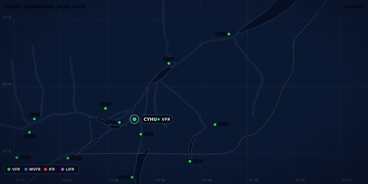
METAR CYHU 031800Z 27014G22KT 15SM SCT035 BKN060 07/M01 A2968
METAR CYRQ 031800Z 25010KT 6SM -SHRA BKN020 OVC040 08/04 A2958
METAR CYQB 031800Z 20012G20KT 8SM -RA BKN025 OVC060 08/05 A2950
The flight stays in the altimeter-setting region, so CARs 602.35 applies:
- Before takeoff at St-Hubert (CYHU): set 29.68. Check that the altimeter reads the field elevation within ±50 ft (TC AIM AIR 1.5.1).
- En route: set the nearest station along the route. When Trois-Rivières (CYRQ) is the nearest one, set 29.58.
- Before the descent into Québec City (CYQB): set 29.50.
Now forget steps 2 and 3. You arrive over Québec City with 29.68 on the subscale, 0.18 inHg too high. TC AIM AIR 1.5.3 puts it in capitals: “A TOO HIGH SUBSCALE SETTING MEANS A TOO HIGH ALTIMETER READING”. At 1,000 ft per inch, you are about 180 ft lower than the altimeter shows. The standard-atmosphere formula gives about 170 ft. On the way back, the error turns around: the altimeter reads low, and you are higher than it shows.
The TC AIM’s own example (AIR 1.5.3) is larger. A pilot keeps 29.80 set into an area where the setting is 29.20. Over a 4,800 ft ridge at an indicated 6,000 ft, the ground clearance is 600 ft, not the 1,200 ft the pilot expects.
United States: the lowest usable flight level
A constructed example: the altimeter setting in your area is 29.50. The 91.121(b) table gives FL185 as the lowest usable flight level, not FL180.
Computed with the standard atmosphere: at FL180, an altimeter set to 29.50 would read about 17,600 ft. At FL185, it would read about 18,100 ft. TC AIM’s 1,000 ft per inch gives 420 ft for the 0.42 inHg difference; the formula gives about 390 ft.
France: through the transition altitude
A constructed example: the QNH is 1003 hPa, and the transition altitude is 5,000 ft, the value when the VFR chart shows no other one (AIP France ENR 1.7.2.3).
- Climbing: you set 1013.2 hPa at the latest as you cross 5,000 ft. The altimeter jumps from 5,000 to about 5,280 ft, because the QNH is 10.2 hPa below standard pressure (computed, about 27 ft per hPa).
- On flight levels: FL055 is then about 5,220 ft on the QNH, and FL060 about 5,720 ft (computed).
- Descending: you set the QNH again at the latest as you cross the transition level.
What the setting does not correct
The altimeter setting corrects the altimeter for pressure. It does not correct it for temperature or for wind over mountains.
- Temperature. The altimeter shows the true altitude at all levels only in standard-atmosphere conditions. TC AIM AIR 1.5.4 puts the error at about 4 % of the indicated altitude for every 11 °C between the average temperature of the air column and the standard one. It adds that in winter, with strong low-level inversions, altimeters “habitually” over-read.
- Mountain waves. TC AIM AIR 1.5.8 warns that mountain waves and a non-standard temperature together can make the altimeter over-read by as much as 3,000 ft.
- Very high pressure. Cold, dry air can push the pressure above 31.00 inHg. Most altimeters cannot be set above 31.00, and then the true altitude is higher than the indicated altitude (TC AIM AIR 1.5.9).
Next: density altitude, which starts from the pressure altitude.
Sources
- CARs 602.35: altimeter-setting and operating procedures in the altimeter-setting region, Justice Laws Website
- CARs 602.36: altimeter-setting and operating procedures in the standard pressure region, Justice Laws Website
- CARs 602.37: altimeter-setting and operating procedures in transition between regions, Justice Laws Website
- CARs 101.01: definitions (altimeter setting region, standard pressure region, flight level), Justice Laws Website
- TC AIM (TP 14371) 2026-2, RAC 2.10 and 2.11: altimeter setting region and standard pressure region, Transport Canada
- TC AIM (TP 14371) 2026-2, MET 8.2: the altimeter group and SLP in a Canadian METAR, Transport Canada
- TC AIM (TP 14371) 2026-2, AIR 1.5.1 to 1.5.4, 1.5.8 and 1.5.9: the pressure altimeter and its errors, Transport Canada
- Designated Airspace Handbook (TP 1820E), Issue 324, glossary: altimeter setting region, standard pressure region, NAV CANADA
- 14 CFR 91.121: Altimeter settings, eCFR
- 14 CFR 1.1: General definitions (flight level), eCFR
- Federal Meteorological Handbook No. 1 (FCM-H1-2019), 11.3 to 11.5 and 12.6.11: pressure and the altimeter group, Office of the Federal Coordinator for Meteorology
- Guide aviation 2024, pp. 6, 17, 28 and 30: QNH, QFE, pressure altitude and the Q group, Météo-France
- AIP France ENR 1.7: altimeter setting procedures (eAIP AIRAC 2026-10-29), Service de l'Information Aéronautique
- Pressure Conversion (formula sheet), NOAA National Weather Service
- Pressure Altitude (formula sheet), NOAA National Weather Service
- METAR data: CYUL, CYYC, KDEN and LFPG reports of November 6, 2026, NOAA Aviation Weather Center
Rules checked on
Common questions
What is the difference between QNH and QFE?
With QNH set, the altimeter shows your altitude above sea level; with QFE set, it shows your height above the aerodrome's reference point, the highest point of its landing area (Météo-France Guide aviation 2024, p. 30). A METAR gives the QNH; in France, ATC gives the QFE on request (AIP France ENR 1.7.2.3).
When do I set 29.92 in Canada?
In the standard pressure region: at or above 18,000 ft ASL everywhere, and at every height outside the altimeter-setting region in the north (TC AIM RAC 2.11). You set 29.92 immediately after you climb into it, and a station's setting immediately before you descend out of it (CARs 602.37).
What does A2992 mean?
It is an altimeter setting of 29.92 inches of mercury: the A marks inches of mercury, and you put a decimal point after the second digit (TC AIM MET 8.2, FMH-1 12.6.11). 29.92 inHg is standard pressure, 1013.2 hPa, and a French METAR writes the same pressure as Q1013, the QNH rounded down to the whole hectopascal (Météo-France Guide aviation 2024, p. 17).
Let the app do the decoding.
ClearMETAR turns every METAR and TAF into one plain sentence. Free on iPhone.