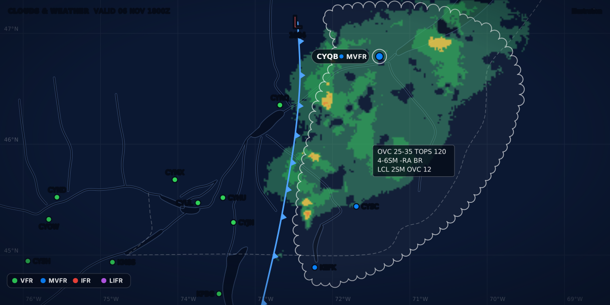
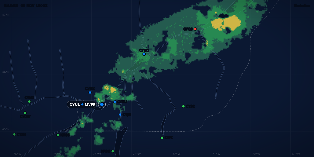
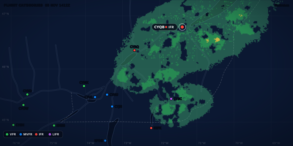
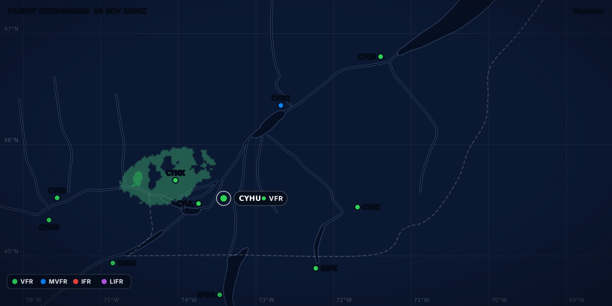
FLIGHT CATEGORIES 15 OCT 2022 1100Z
VFRMVFRIFRLIFR
Illustration
Fog types for pilots: radiation, advection and the spread rule
How radiation, advection and other fog types form, how METARs code fog in Canada, the US and Europe, and what the dew point spread really tells you.
 Jp Valery
18 min read
Fog is a cloud based on the ground. NAV CANADA calls it the most common and persistent obstruction to visibility in aviation (The Weather of Ontario and Quebec, chapter 2). On one clear October night, it took Montréal / St-Hubert from 9 SM to 3/8 SM in 2 hours 17 minutes.
This guide covers the fog types, how a METAR codes fog in Canada, the US and Europe, and what the temperature-dew point spread can and cannot tell you. It is part of the aviation weather products series.
The examples come from that night: Montréal / St-Hubert (CYHU), 14 to 15 October 2022, from the IEM archive. NAV CANADA uses the same night as a case study.
The fog types pilots must know
| Type | How it forms | What to expect |
|---|---|---|
| Radiation fog | On a clear night, the air near the ground cools below its dew point (NWS glossary; LAKP). | Typically forms after midnight and peaks early in the morning. Burns off from the edges after sunrise (LAKP). |
| Advection fog | Warm, moist air moves over a colder surface: land, cold water, snow or ice (NAV CANADA). | Broad and often thicker than other fog. Can last for days, until the wind shifts. |
| Upslope fog | Moist, stable air is carried up a mountain slope (NWS glossary). | Lasts as long as the wind and the spread support it (NAV CANADA). |
| Valley fog | Radiation fog where cold air pools in low ground (NAV CANADA, LAKP). | At Mirabel, it tends to last until late morning (LAKP). |
| Precipitation (frontal) fog | Precipitation ahead of a warm front falls through cooler air near the ground and saturates it (LAKP). | Breaks in the precipitation usually make it thicker. |
| Steam fog | Very cold air moves over relatively warmer water (LAKP). | Usually no more than 50 to 100 ft thick. Can cause significant icing. |
| Freezing fog | Fog whose droplets freeze on contact with exposed objects (NWS glossary). | Rime ice on the aircraft, even when you taxi (LAKP). |
| Ice fog | Water vapour turns directly into ice crystals, in light wind at about −30 °C or colder (LAKP). | Can close an airport for hours or days. |
Sources: NWS glossary; NAV CANADA Aviation Meteorology Reference (radiation and advection fog pages); NAV CANADA LAKP Ontario and Quebec (2002), chapter 2 and p. 133. Each type has its own section below.
Fog or mist? The visibility line in Canada, the US and Europe
Fog and mist are the same water droplets. In a report, only the visibility separates them.
| Where | Fog (FG) |
Mist (BR) |
Source |
|---|---|---|---|
| Canada | 1/2 SM or less | 5/8 to 6 SM | MANOBS 6.7.1.1 and 6.7.1.3 |
| United States | Less than 5/8 SM | 5/8 SM to less than 7 SM | FMH-1 8.3.2 |
| WMO (international) | Less than 1 km | 1 km or more | International Cloud Atlas 3.2.1.1.1 |
| France | Less than 1 km | 1 to 5 km | Météo-France, Guide aviation 2024, lexique |
- Canada. The TC AIM writes the same line as fog below 5/8 SM and mist at 5/8 SM or more (MET Table 8.1). 1/2 and 5/8 SM are next to each other in the list of reportable values (MANOBS Table 4-1), so the two texts agree.
- Close enough. 5/8 SM is 1,006 m (computed). The North American line and the 1 km line are almost the same.
- Light fog. The WMO adds that, in practice, mist means the same as “light fog”.
- When it shows. Canada records an obstruction to vision only at 6 SM or less (MANOBS 6.7.1). In the US, an obscuration goes in the body when the visibility is less than 7 SM or it is operationally significant (FMH-1 8.5 and 12.6.8).
A plain FG group at the station always means LIFR. Fog keeps the visibility below 5/8 SM, and the Aviation Weather Center puts LIFR below 1 mile (AWC GFA help). Mist can fall in any category, from LIFR at 5/8 SM to VFR at 6 SM. The category is a summary; the minimums are the law (flight categories).
Radiation fog
This is the fog that closes your field at dawn.
At night, the ground loses heat to space, and the air just above it cools (LAKP, chapter 2). When that air cools below its dew point, radiation fog forms (NWS glossary). The LAKP gives the usual timing: clear sky and light wind, typically after midnight, with a peak early in the morning.
NAV CANADA’s radiation fog page gives the setup and the traps:
- The setup. Clear nights, generally under a ridge, with high humidity.
- The wind. NAV CANADA lists “light but not calm” winds among the conditions that support fog. A light wind mixes the cooled air into a pool of mist that can grow in depth overnight. In a calm, the moisture settles as dew, or as frost below freezing. A strong wind disperses the fog.
- The speed. As the pool grows, runway visibility can drop from VFR to 1/2 SM or less in less than an hour.
- Cirrus. A cirrus layer works like a blanket and stops the full night cooling. Cirrus that was not forecast can stop the fog. Forecast cirrus that does not come, or comes thinner, lets the fog form.
- The season. Late summer and fall, when nights are long and the air is humid. Closer to winter, the fog is thicker and takes longer to burn off.
- The places. Near lakes and irrigated farmland, and in valleys where cold air pools overnight. For the case-study night, NAV CANADA’s model forecasts and satellite images point to the St. Lawrence and Champlain valleys, the Eastern Townships and the Saguenay.
After sunrise, radiation fog burns off from the edges over land. Fog that drifted over water takes longer (LAKP, chapter 2). In late summer, the fog is thin and usually burns off quickly. But the visibility can first drop a little: as the ground warms, mixing at the surface and at the edges can thicken the fog before it burns off (NAV CANADA).
Advection fog
Advection fog forms when warm, moist air moves over a much colder surface and cools from below until it is saturated. The surface can be land, cold water, snow or ice (NAV CANADA, advection fog).
It needs air that is already close to saturation, a steady supply of moisture (for example, wind from open water onto cold land) and a large temperature difference between the air and the surface. NAV CANADA’s examples have light to moderate winds.
What makes it different from radiation fog:
- Size. It is broad, and often thicker than other fog types. Radiation fog forms “pools” in low open ground.
- Time. It lasts as long as the conditions do. In NAV CANADA’s words, it “can persist for days on end, until there is a wind shift”. Even with daytime heating, it takes longer to thin out.
- Clearing. Over land, the sun lifts it into stratus. Over water, it stays as fog. After sunset, onshore winds can push it back over land.
In Canada, NAV CANADA names the waters off Newfoundland (with St. John’s, CYYT, as a case study), the Great Lakes in spring and the Arctic in summer. In winter, mild air moving north over snow cover or cold, frosty ground can make advection fog. The same page quotes users: a northern operator calls fog a major player in its Nunavik operation, where all the airports are on the coast, and at Montréal-Trudeau (CYUL), a fog layer 75 ft deep can move in from the St. Lawrence and cover the whole airport.
Upslope, valley, precipitation and steam fog
- Upslope fog. Moist, stable air is carried up a mountain slope (NWS glossary). NAV CANADA says it can last as long as the wind and the temperature-dew point spread support it (advection fog page).
- Valley fog. Radiation fog is common in valleys, where cold air pools overnight (NAV CANADA, radiation fog page). Near Montréal, the LAKP says fog with 5/8 SM or less is much more frequent at Mirabel (CYMX) than at Dorval (CYUL), likely because cold air drains from the mountains to the north. For the same reason, it tends to last until late morning. Fog is also more frequent at St-Hubert than at Dorval (LAKP, p. 133).
- Precipitation, or frontal, fog. It forms ahead of a warm front. Precipitation falls through a cooler layer of air near the ground and saturates it. Breaks in the precipitation usually make the fog thicker (LAKP, chapter 2).
- Steam fog. Very cold arctic air moves over relatively warmer water. The water evaporates, and the cold air cannot hold all the moisture, so fog forms. It looks like steam or smoke rising from the water and is usually no more than 50 to 100 ft thick. It is also called arctic sea smoke, and it can cause significant icing (LAKP, chapter 2).
Freezing fog and ice fog
Freezing fog (FZFG) is fog below 0 °C.
- Canada. An observer reports freezing fog when the temperature is from −0.1 to −30.0 °C and the visibility is 1/2 SM or less. Below −30.0 °C, only with clear evidence of ice building up from the fog (MANOBS 6.7.1.2).
- United States. Ice crystals, or water droplets below 0 °C, based at the surface (FMH-1, Appendix A glossary).
- The code.
FZgoes only with fog, drizzle or rain (TC AIM MET 8.2; FMH-1 12.6.8.b(5)).
Freezing fog is common in winter. It holds many supercooled water droplets, at temperatures just below freezing (0 to −10 °C). Expect rime ice when you land, take off or even taxi in it (LAKP, chapter 2). NAV CANADA adds that, in winter, radiation fog becomes freezing fog and increases icing on the runway (radiation fog page).
In Canada, a station takes a special report when freezing fog begins or ends (MANOBS 11.2.3.2; TC AIM MET 8.3.1(g)). The SPECI guide sets the Canadian and US triggers side by side. NAV CANADA AWOS stations can report FZFG too, along with FG, BR, HZ and BLSN (TC AIM MET 8.4.3(g)).
Ice fog is made of ice crystals, not droplets: the water vapour turns directly into ice. It needs light wind and a temperature of about −30 °C or colder. The vapour comes from man-made sources or from cracks in ice-covered rivers. Heating systems, and even aircraft engines, can bring the local visibility down to near zero and close an airport “for hours or even days” (LAKP, chapter 2).
Fog in a METAR and a TAF
A METAR codes fog with FG and a few qualifiers. The METAR codes guide lists every weather code; here is the fog detail.
| Code | Meaning | Canada | United States |
|---|---|---|---|
FG |
Fog | 1/2 SM or less (MANOBS 6.7.1.1) | Less than 5/8 SM (FMH-1 8.3.2) |
BR |
Mist | 5/8 to 6 SM (MANOBS 6.7.1.3) | 5/8 SM to less than 7 SM (FMH-1 8.3.2) |
FZFG |
Freezing fog | −0.1 to −30.0 °C and 1/2 SM or less (MANOBS 6.7.1.2) | Droplets below 0 °C, or ice crystals (FMH-1 glossary) |
MIFG |
Shallow fog | Low fog that does not hide eye level (1.5 m), even if the visibility inside it is 1/2 SM or less (MANOBS 6.8.1.3) | 5/8 SM or more at 6 ft above the ground, less than 5/8 SM inside the layer (FMH-1 glossary) |
BCFG |
Patches of fog | Patches at least 1.5 m deep over less than half of the ground; 1/2 SM or less inside a patch (MANOBS 6.8.1.1) | Patches that randomly cover the station (FMH-1 glossary) |
PRFG |
Partial fog | A fog bank over part of the aerodrome, with at least half of the ground covered inside it (MANOBS 6.8.1.2) | A substantial part of the station in fog, the rest clear (FMH-1 glossary) |
VCFG |
Fog in the vicinity | Within 5 SM, but not at the station (MANOBS 6.7.1.8; TC AIM MET 8.2) | Between 5 and 10 SM, not at the station (FMH-1 8.5 and 12.6.8.a(2)) |
Three rules to remember:
MI,BCandPRgo only with fog (TC AIM MET 8.2(c); FMH-1 12.6.8.b(1)). Mist (BR) never takes a descriptor (FMH-1 12.6.8.b).MIFG,BCFGandPRFGcan come with a high prevailing visibility: above 6 SM in Canada (MANOBS 6.8.1), 7 SM or more in the US (FMH-1 12.6.8.d(2)). A report can say 15 SM and still have fog on the field.- Canadian reports give the details in the remarks. MANOBS shows
BCFG SE VIS 1/4,PRFG SE-N VIS 1/2andMIFG OVR APCH RWY 27(6.8.1.1.1, 6.8.1.2.1 and 6.8.1.3.1). Directions go clockwise, soPRFG SE-Nis fog from the southeast to the north (TC AIM MET 8.2).
Québec City (CYQB) shows the patches on the morning of 15 October 2022. These are real reports from the IEM archive, as stored (the archive drops the word METAR or SPECI):
CYQB 151000Z VRB02KT 15SM R06/3000VP6000FT/D SKC 05/05 A2999 RMK BCFG DIST S SLP160
CYQB 151043Z 26006KT 15SM R06/2600VP6000FT/N BCFG FEW001 FEW008 SCT150 04/04 A2998 RMK ST1ST1AC3 ST TR ST TR VIS W-NW 3/4 SLP158
CYQB 151048Z 26006KT 1/2SM R06/1600V1800FT/N FG VV001 05/05 A2998 RMK FG8 SLP158
CYQB 151215Z 25003KT 1 1/4SM BR VCFG FEW002 SCT150 06/06 A3001 RMK FG1ST1AC1 VIS W-N 5 SLP166
At 1043Z, the prevailing visibility is 15 SM. But BCFG reports patches of fog, and the remark VIS W-NW 3/4 gives only 3/4 SM toward the west and northwest. Five minutes later, the fog covers the station: 1/2 SM in FG. At 1215Z, it is mist at the station and fog nearby (BR VCFG).
The remarks FG8 and FG1 give the fog layer in eighths of the sky (TC AIM MET 8.2); the METAR remarks guide explains these digits. When fog hides the whole sky, the report gives a vertical visibility instead of a cloud base: VV001 is 100 ft, and it counts as the ceiling (TC AIM MET 8.2; see what is a ceiling).
In a TAF, fog uses the same codes, and it can sit in a change group. In NAV CANADA’s case study of this night, the 0844Z TAF for Montréal-Trudeau (CYUL) gave a PROB30 from 0900Z to 1200Z with mist, 3/4 SM and broken cloud at 200 ft, partly because CYUL was expected to sit just outside the lowest conditions. CYUL reported fog with 1/2 SM at 1100Z. The TAF guide reads a whole forecast, and PROB30 and TEMPO have their own page.
The temperature-dew point spread: what it predicts and what it cannot
The spread is the temperature minus the dew point, both from the temperature group of the METAR (how to read a METAR). Fog forms when the air near the surface cools below its dew point (NWS glossary), so a small spread is a warning. But four sources say four different things:
| Source | What it says |
|---|---|
| FAA, How to Obtain a Good Weather Briefing (FAA-P-8740-30) | “Be especially cautious when the temperature and dewpoint spread is 3 °C or less—fog may form.” |
| NAV CANADA, Aviation Meteorology Reference (2022 case study) | At CYUL, from 1100Z to 1400Z, the temperature and dew point “remain either equal or within one degree of one another” in the fog. |
| NAV CANADA, LAKP Ontario and Quebec, chapter 2 | With many condensation nuclei in the air, radiation fog may form before the spread reaches zero. |
| CAA Norway inspector, GA newsletter article (2026, not a rule) | A 4 °C spread may be a reasonable margin on a spring day, but in autumn “4°C may not be sufficient to prevent fog formation”. |
Read together: no spread number is a guarantee, and the spread is not a clock. It tells you fog is possible. It does not tell you when. On the CYHU night, the spread was 5 °C at 2200Z, about 10 minutes before sunset. At 0300Z it was 0 °C, with 9 SM and a clear sky. Mist came 46 minutes later, and fog 2 hours 17 minutes later.
The rounding trap
The METAR body gives whole degrees. In Canada, a value is rounded to the nearest degree, and a value of exactly .5 goes to the warmer degree (TC AIM MET 8.2; MANOBS 8.3). The US also rounds to the nearest degree, and −0.5 °C is coded M00 (FMH-1 12.6.10). So the body hides up to almost 2 °C of the spread (computed):
| Body | True spread |
|---|---|
07/07 |
0 to just under 1 °C |
05/04 |
Just above 0 to just under 2 °C |
14/09 |
Just above 4 to just under 6 °C |
US stations that are designated for it add the tenths in a T group in the remarks (FMH-1 12.7.2(d)). FMH-1’s own example, T00261015, is 2.6 °C and −1.5 °C. Here is a real one from Newport, Vermont (KEFK), the same morning (IEM archive, as stored):
KEFK 150955Z AUTO 23003KT M1/4SM FG OVC001 06/04 A3004 RMK AO2 T00550042The body says 06/04, a spread of 2 °C. The T group says 5.5 °C and 4.2 °C: a spread of 1.3 °C, in fog with less than 1/4 SM. The Canadian reports in this guide carry no tenths group, so the body is all you get.
A real fog night at CYHU, report by report
All the reports below are real, from the IEM archive for CYHU, 14 to 15 October 2022. The archive stores them without the word METAR or SPECI. It is added back here from the archive’s report type. Local time is EDT (UTC−4). Sunset was at about 22:10Z (18:10 EDT) on the 14th, and sunrise at about 11:10Z (07:10 EDT) on the 15th (computed with the NOAA solar equations). The civil twilight calculator gives the same times to within a minute.
At 0300Z, the spread is zero, but the field is VFR:
Here is the night in 14 reports. The category is the flight category from the ceiling and the visibility.
| UTC (EDT) | Type | Report (part) | Spread | Category | What happened |
|---|---|---|---|---|---|
| 14th 2200Z (18:00) | METAR | 11005KT 9SM CLR 14/09 |
5 | VFR | About 10 minutes before sunset |
| 15th 0000Z (20:00) | METAR | 14004KT 9SM CLR 10/08 |
2 | VFR | The spread closes |
| 0300Z (23:00) | METAR | 12002KT 9SM CLR 07/07 |
0 | VFR | Spread zero, still 9 SM |
| 0346Z (23:46) | SPECI | 00000KT 5SM BR CLR 07/06 |
1 | MVFR | First mist, 46 min later |
| 0434Z (00:34) | SPECI | 00000KT 1 1/4SM BR CLR 06/06 |
0 | IFR | |
| 0517Z (01:17) | SPECI | 00000KT 3/8SM FG CLR 06/05 |
1 | LIFR | First fog, 2 h 17 min after spread zero |
| 0624Z (02:24) | SPECI | 11003KT 6SM BR CLR 04/04 |
0 | VFR | The fog breaks for a while |
| 0715Z (03:15) | SPECI | 00000KT 3/8SM FG CLR 05/04 |
1 | LIFR | Fog again, for almost 7 hours |
| 0900Z (05:00) | METAR | VRB02KT 1/4SM FG VV001 05/04 |
1 | LIFR | Sky obscured |
| 1100Z (07:00) | METAR | 03003KT 0SM FG VV002 05/05 |
0 | LIFR | 10 minutes before sunrise |
| 1412Z (10:12) | SPECI | 12004KT 060V140 1/2SM FG VV002 07/07 |
0 | LIFR | Last fog, 3 hours after sunrise |
| 1424Z (10:24) | SPECI | 13004KT 070V140 2SM BR OVC002 08/07 |
1 | LIFR | The fog lifts into a 200 ft overcast |
| 1500Z (11:00) | METAR | 09006KT 9SM BKN004 09/09 |
0 | LIFR | Ceiling 400 ft |
| 1510Z (11:10) | SPECI | 09006KT 9SM SCT004 09/09 |
0 | VFR | The low cloud scatters |
The first fog report:
Just before sunrise, the visibility is 0 SM, and the fog hides the sky: vertical visibility 200 ft.
The fog does not simply clear. It lifts into stratus, and the ceiling keeps the field LIFR:
Other fields fogged in the same morning (IEM archive, as stored):
CYMX 151000Z VRB02KT 25SM SKC 03/03 A3000 RMK SLP165
CYMX 151031Z 04005KT 3/8SM R06/1600V2000FT/N FG VV001 03/02 A3000 RMK FG8 SLP165
CYUL 151100Z 03006KT 1/2SM R06L/1200V1600FT/N R06R/1400V1800FT/N FG VV001 05/04 A3000 RMK FG8 SLP161
CYUL 151102Z 03006KT 4SM R06L/1200V1600FT/N R06R/1400V1600FT/N BR BKN016 OVC250 05/04 A3000 RMK FG2SF5CI1 SLP161
At 1000Z, Mirabel (CYMX) had 25 SM, a clear sky and a spread of zero. At 1031Z, it had 3/8 SM in fog. Montréal-Trudeau (CYUL) went from 1/2 SM in fog to 4 SM in mist in 2 minutes. NAV CANADA’s case study puts CYUL at the edge of the densest fog, with a later start, more ups and downs and an earlier end than CYHU.
What the night teaches:
- A wide spread at sunset is no protection. It was 5 °C at CYHU, in mid-October.
- A spread of zero is not fog yet. At 0300Z the field was still 9 SM and VFR.
- Reports swing. 3/8 SM in fog at 0517Z, 6 SM in mist at 0624Z, fog again at 0715Z.
- Sunrise is not the end. The last fog report came 3 hours after sunrise. The field stayed LIFR until 1510Z, 4 hours after sunrise.
- The forecast struggles too. NAV CANADA says the CYHU TAF forecast the fog to clear by 1300Z, and it was amended and extended later in the morning. NAV CANADA names the difficulty of forecasting fog clearing in the shoulder seasons, when the sun is weaker than in summer.
Before you fly at dawn
None of these is a rule. They come from the sources above and from the CYHU night.
- Watch the trend, not one number. At CYHU, the spread went 5, 3, 2, 2, 1, 0 in five hours.
- Look for the setup. Clear sky, light wind and humid air under a ridge is the radiation fog setup (NAV CANADA). Forecast cirrus that does not show up removes the blanket.
- Mind the season. The same spread is less safe on a long autumn night than on a spring day (CAA Norway article).
- Know the sunrise, then add hours. Sunrise is when clearing can start, not when it ends. The civil twilight calculator gives the sun times for an airport and a date.
- Read the TAF change groups.
FGorBRin aTEMPOorPROBgroup is a real possibility for your arrival time. - Have an out. Around 1100Z on 15 October 2022, CYHU, CYUL, CYMX and CYQB were all LIFR, and so were Trois-Rivières (CYRQ), Sherbrooke (CYSC) and Newport, Vermont (KEFK). Ottawa (CYOW) and Plattsburgh (KPBG) were VFR (IEM archive). A fog area can cover your alternate too. IFR pilots: see the alternate requirements.
- Set your limit before you look. The personal minimums checklist helps you write it down.
On a station screen, ClearMETAR shows the dew point and the spread under the temperature, gives the weather in words (mist, fog, freezing fog, patches of fog), and draws the sunrise in its Day and night panel.
Neither of the fields I fly from, CSE4 and CSB3, has a weather report. Fog at a field like that shows in no METAR at all. The guide to weather without a METAR covers that case.
Sources
- International Cloud Atlas, 3.2.1.1.1: fog compared with mist, World Meteorological Organization
- MANOBS, 8th edition, Amendment 3 (September 2026), Table 4-1, 6.7.1, 6.8.1, 8.3 and 11.2.3.2, Environment and Climate Change Canada
- TC AIM (TP 14371) 2026-2, MET 8.2, 8.3.1(g), 8.4.3(g) and Table 8.1, Transport Canada
- Federal Meteorological Handbook No. 1 (FCM-H1-2019), 8.3.2, 8.5, 12.6.8, 12.6.10, 12.7.2(d) and Appendix A glossary, Office of the Federal Coordinator for Meteorology
- Glossary: fog, radiation fog, advection fog, upslope fog, steam fog, freezing fog and ice fog, National Weather Service
- Aviation Meteorology Reference: Radiation Fog (with the 15 October 2022 case study), NAV CANADA
- Aviation Meteorology Reference: Advection Fog, NAV CANADA
- The Weather of Ontario and Quebec (LAKP, GFACN33), 2002, chapter 2 and p. 133, NAV CANADA
- How to Obtain a Good Weather Briefing (FAA-P-8740-30), FAA Safety Team
- GFA help: flight category limits, NOAA Aviation Weather Center
- Guide aviation 2024, lexique: brouillard and brume, Météo-France
- Dew point spread and radiation fog (GA Newsletter Norway article by a CAA Norway flight operations inspector, 25 September 2026), EASA Community
- ASOS/METAR archive: CYHU and nearby stations, 14-15 October 2022 (data), Iowa Environmental Mesonet
Rules checked on
Common questions
What is the difference between fog and mist?
In a report, only the visibility: in Canada, fog is reported at 1/2 SM or less and mist from 5/8 to 6 SM (MANOBS 6.7.1.1 and 6.7.1.3), and in the US fog is below 5/8 SM and mist from 5/8 SM to less than 7 SM (FMH-1 8.3.2). The WMO line is 1 km (International Cloud Atlas 3.2.1.1.1).
What dew point spread means fog?
No fixed number: the FAA says to be especially cautious at 3 °C or less (FAA-P-8740-30), and NAV CANADA notes that, with many condensation nuclei in the air, radiation fog may form before the spread reaches zero (LAKP Ontario and Quebec, chapter 2). In NAV CANADA's 15 October 2022 case study, the temperature and dew point at CYUL stayed equal or within one degree of each other during the fog (Aviation Meteorology Reference).
What is the difference between radiation and advection fog?
Radiation fog forms on a clear night with light wind, when the air near the ground cools below its dew point, and it burns off from the edges after sunrise (NWS glossary; LAKP chapter 2). Advection fog forms when warm, moist air moves over a colder surface, and it can last for days until the wind shifts (NAV CANADA Aviation Meteorology Reference).
Let the app do the decoding.
ClearMETAR turns every METAR and TAF into one plain sentence. Free on iPhone.