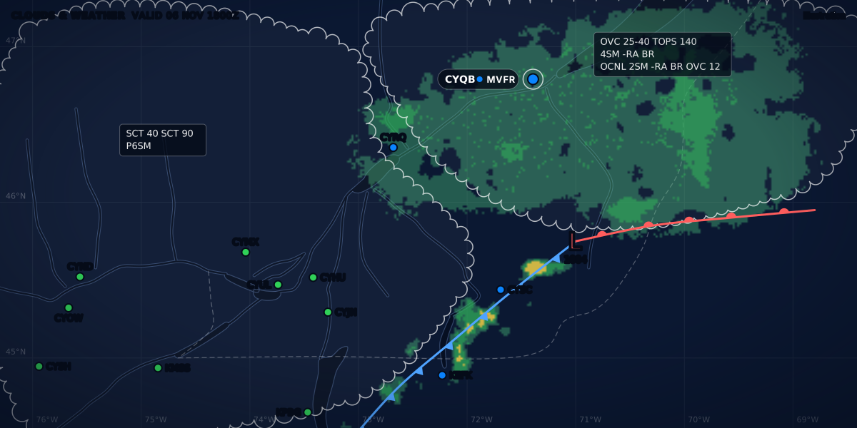
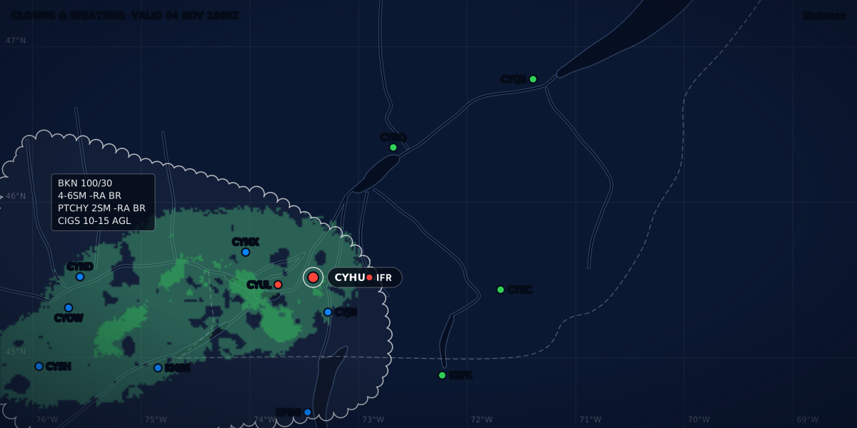
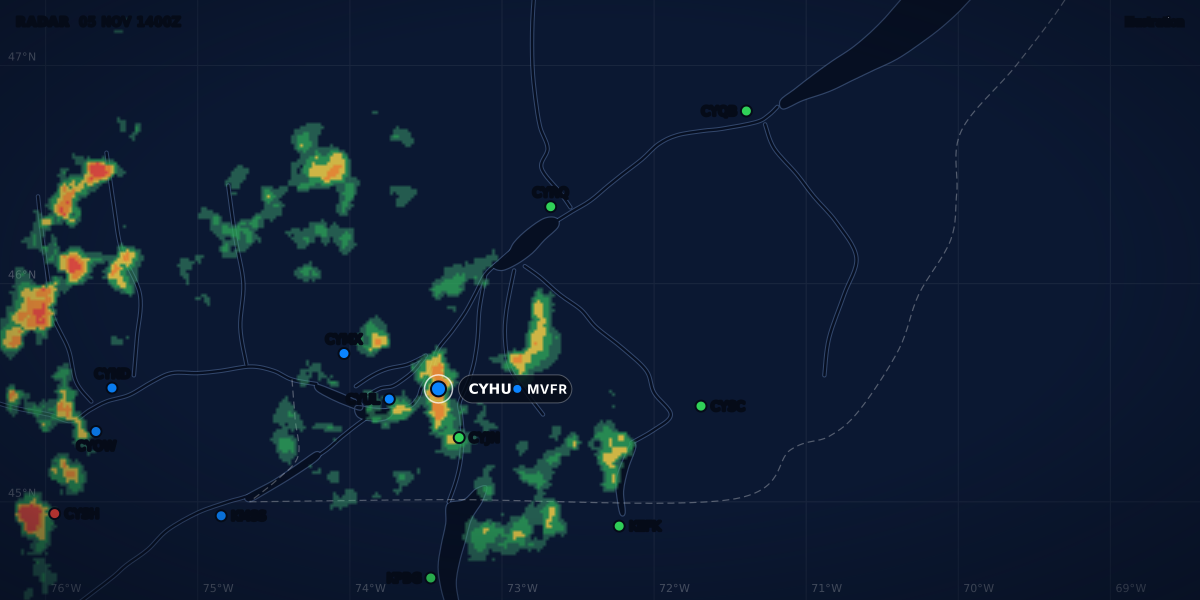
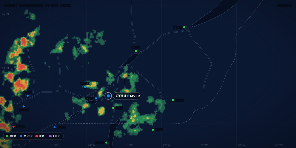
FLIGHT CATEGORIES 12 OCT 2200Z
VFRMVFRIFRLIFR
Illustration
No METAR at your airport? Where to get the weather
No METAR or TAF at your field? The nearest station and how far to trust it, the GFA, AWOS, LWIS, weather cameras, and the rules in Canada and the US.
 Jp Valery
14 min read
I fly from two fields with no weather report: CSE4 Lachute, where I trained, and CSB3 St-Mathieu-de-Beloeil. At a field like these, no METAR and no TAF describe your runway. You build the picture from other sources: the nearest stations, the area forecast, automated stations, cameras, and what you see on arrival. This guide covers each source, how far to trust it, and the rules in Canada and the US. It is one step of a full weather briefing.
Two reports, 14 NM apart
Here is a real case. The nearest reporting station to CSB3 is Montréal / St-Hubert (CYHU), 8.7 NM to the west-southwest. Montréal-Trudeau (CYUL) is 22.3 NM away, in about the same direction. These are their 22:00Z reports of October 12, 2025 (18:00 local time), from the IEM archive:
The METAR guide decodes every group. CYHU, an automated station (AUTO), reported 1 SM in haze: IFR. CYUL, about 14 NM from CYHU, reported 30 SM: VFR. In the same ten minutes, nine other stations from Ottawa to Québec City, and across the border in New York and Vermont, reported 9 SM or more with no ceiling. At 19:00Z, CYHU itself had reported 9 SM. At 00:00Z it still reported 2 1/4 SM in haze.
R24R/P6000FT/U is the runway visual range on runway 24R: above the top of the instrument range (6,000 ft), with an upward trend. A Canadian report includes it when the visibility is 1 SM or less (TC AIM MET 8.2).
Which report described the sky over CSB3 that evening? Neither report can tell you. The two stations do not measure visibility the same way. The TC AIM compares the methods: a NAV CANADA automated station measures visibility with “fixed, unidirectional, forward scatter techniques”, and a human observer reports the prevailing visibility, “common to at least half the horizon circle” (MET 8.4.4, Table 8.3). For an automated station, the TC AIM adds: “One report in a series should not be expected to represent the prevailing condition” (MET 8.4.1).
So you do not stop at the nearest report. You read the stations around you, the trend, the area forecast and a camera if there is one. Then you plan a way out. The rest of this guide takes those steps one at a time.
What “no METAR” means
In Canada, METARs are taken every hour on the hour at over 200 aerodromes (TC AIM MET 1.2.1). TAFs exist only where METAR and SPECI reports exist (MET 1.3.3). So a field with no METAR has no TAF either.
The Canada Flight Supplement (CFS) is the reference: “if the CFS does not list a METAR/SPECI service for an aerodrome in the aerodrome Flight Planning section, then it does not have one” (MET 1.2.4.2). Apps can blur this. The TC AIM warns that “some Electronic Flight Bags may indicate that some weather reports are METAR when they are not” (MET 1.2.7).
When a Canadian station is more than 1.6 NM from the centre of the runways, its report has a different identifier from the aerodrome. The TC AIM’s example: Cartwright aerodrome is CYCA, and its weather report is CWCA (MET 8.4.4, Table 8.3). A report under a different identifier is a sign that the observation is not taken at the runways.
In the US, ASOS is one of the major programs of the surface observation network, with “around 950” sites. It is a joint program of the National Weather Service, the FAA and the Department of Defense (NWS).
What the rules say
Neither the Canadian nor the US preflight rule needs a weather report at your own field.
- Canada. CARs 602.72: “The pilot-in-command of an aircraft shall, before commencing a flight, be familiar with the available weather information that is appropriate to the intended flight.” The TC AIM quotes it in full (MET 1.1.9).
- United States. 14 CFR 91.103: each pilot in command “shall, before beginning a flight, become familiar with all available information concerning that flight.” For a flight under IFR or “not in the vicinity of an airport”, that information must include weather reports and forecasts (91.103(a)).
Neither rule names a station or a distance. The words are “available” and “appropriate”. At a field with no report, the available information is the nearest reports, the area forecast and what you can see.
The TC AIM adds guidance on unofficial sources. Weather services that are not in the flight publications “are of an unknown performance and can be used for VFR flights at the discretion of the pilot”, but never for instrument procedures (TC AIM MET 1.2.3). The TC AIM also describes VFR weather stations, meant only for local use by VFR pilots. They are not published in the CFS, they are not allowed at aerodromes with instrument approaches, and pilots use them “at their discretion for VFR” (MET 1.2.4.2).
The VFR weather minimums guide gives the legal limits. They apply to the conditions where you fly, not at the station that reports. A flight category such as VFR or IFR is a summary; the minimums are the law.
The nearest METAR and TAF: how far can you trust it?
| What | Distance | Source |
|---|---|---|
| A Canadian observation is representative of the aerodrome | Within 1.6 NM (3 km) of the geometric centre of the runway complex | TC AIM MET 7.2 |
| A Canadian TAF covers | About 5 NM around the centre of the runways, “depending on local terrain”. Thunderstorms 5 to 10 NM away are included. | TC AIM MET 7.2 |
| A US TAF covers | 5 SM around the center of the runway complex. “Vicinity” is 5 to 10 SM. | NWSI 10-813, section 4 |
| A Canadian forecast based on observations more than 1.6 NM away | Issued as an aerodrome advisory, ADVISORY OFFSITE, not a TAF |
TC AIM MET 1.3.4 |
| CSB3 to CYHU | 8.7 NM | Computed from the airport positions |
| CSE4 to CYMX | 14.1 NM | Computed from the airport positions |
In Canada, a forecast based on observations taken more than 1.6 NM from the aerodrome centre is not issued as a TAF. It is issued as an aerodrome advisory, because those observations “are not considered to be representative of weather conditions at the aerodrome” (MET 1.3.4). Your nearest station can be much farther away than that: 8.7 NM for CSB3, 14.1 NM for CSE4. Read its report as a picture of the region, not of your runway.
How to read it:
- Read more than one station. Take the nearest two or three, on different sides of your field if you can. If they agree, the picture is stronger. If they disagree, as CYHU and CYUL did, plan for the worse one.
- Read the trend. Look at the last few reports, not only the latest. A visibility that falls hour after hour tells you more than one number.
- Look at what lies between. A river, a lake, a valley or higher ground can give your field a different sky. The TC AIM ties even a TAF’s 5 NM to “local terrain” (MET 7.2).
- Read the TAF as a regional forecast. The nearest TAF describes another field, 5 NM around it. Use it for timing: when a front arrives, when fog should lift.
- Plan for a gap. Fly to your personal minimums, with a margin for the distance, and know where you will go if your field is worse than the report.
ClearMETAR handles a field with no report this way. It shows the report of the nearest reporting station with a line such as “Weather from CYHU, 8.7 NM”, and it names the station behind the TAF. Its weather-source sheet lists up to five nearby reporting stations with their distance and bearing, and you can pick another one. It computes density altitude with your field’s own elevation and the station’s temperature and altimeter setting. It accepts a station up to 250 NM away, so read the distance every time: the app tells you the distance; you judge it.
Density altitude belongs to your field, through its elevation. The density altitude guide shows how to combine your field’s elevation with a nearby station’s numbers.
The area forecast
Between stations, the forecast is the area forecast: the GFA in Canada. A TAF needs a METAR program (TC AIM MET 1.3.3), so at a field with no report the GFA covers your field and no TAF does. The guide how to read a GFA explains the charts, including their heights.
AWOS, ASOS, LWIS and AUTO: what each one reports
An automated station can be a full METAR station or a few sensors. The CFS uses these terms (TC AIM MET 1.2.3):
| CFS term (Canada) | What it reports | Closest US term |
|---|---|---|
| METAR | METAR and SPECI by a qualified human observer | METAR |
| METAR AUTO (an AWOS) | A full automated METAR and SPECI: wind, altimeter, temperature, dew point, visibility, cloud height and cover, precipitation, fog, freezing fog, mist, haze, blowing snow, thunderstorm detection and icing (MET 1.2.5.1) | ASOS |
| LWIS | An hourly report with wind, temperature, dew point and altimeter setting “only” (MET 1.2.3(c)). No visibility, no cloud. | AWOS, which comes in several levels |
| AUTO | A system that does not meet the METAR AUTO or LWIS requirements. It can report anything from one element to almost a full METAR AUTO. It is not on the main network: ask the aerodrome operator (MET 1.2.3(d), 1.2.4.1). | — |
The cross-border trap. The same word means two things. The TC AIM says: “The United States uses the term ‘automated surface observation system’ (ASOS) as the equivalent to Canadian AWOS that provide METAR AUTO reports. Typically, usage of the term AWOS in the United States is equivalent to the Canadian LWIS but with several defined levels of observation capabilities” (MET 1.2.4.1, note). The TC AIM points to the FAA’s Aeronautical Information Manual for the details of the US levels. In the CFS, a local system that its owner calls AWOS but that does not give METAR AUTO reports is listed as AUTO (MET 1.2.4.1). So in the Canadian publications, an AWOS gives METAR AUTO reports. On a US field, an AWOS can be a few sensors.
An LWIS report looks like this. This is the TC AIM’s own example (MET 8.4.2):
LWIS CYXP 221700Z AUTO 25010G15KT 03/M02 A3017=Wind, temperature and dew point, altimeter setting. Nothing on the cloud or the visibility.
Listen on the radio. At some sites, an automated voice broadcast gives the latest observation on a VHF frequency. The CFS gives that frequency in the COMM entry, for example COMM AWOS 124.7 (TC AIM MET 1.2.3). Where an LWIS has a voice system, it feeds it with data updated every minute (MET 1.2.5.2). Near such a station, you get a current wind and altimeter setting before you arrive.
What an automated station misses. A NAV CANADA AWOS reports visibility up to 9 SM only. Its laser ceilometer “views one point directly over the station”, and it reports CLR when it detects no cloud below 25,000 ft above the ground (MET 8.4.4, Table 8.3). It does not report drizzle or freezing drizzle; it usually reports rain or an unknown precipitation type instead (MET 8.4.3(c)). An AWOS outside the lightning detection network cannot report thunderstorms (MET 1.2.3(b)). The METAR codes list shows which weather codes an AUTO report can carry.
Weather cameras
A camera shows what a distant report cannot: the cloud and the visibility over a ridge, a valley or a field.
- NAV CANADA WxCam. “Still images are transmitted to the NAV CANADA CFPS at 10-min intervals.” They are available through a link on the CFPS login page. “Most sites have four separate camera angles, and reference images are included” (TC AIM MET 1.2.3(e)). Cameras that are not on an aerodrome are shown in CFPS too. NAV CANADA has cameras at stand-alone locations and at many AWOS and LWIS sites (MET 8.4.3(k)).
- Webcam. In the CFS, “Webcam” means a camera that does not belong to NAV CANADA. Ask the aerodrome operator about it (MET 1.2.3(f)).
- United States. The FAA has its own camera site, FAA WeatherCams.
Compare the live image with the reference image. If a hill or a tower that shows on the reference image is hidden on the live one, cloud or poor visibility hides it in that direction. A camera image is not a weather report: it gives no ceiling and no visibility number. Use it with the reports, not instead of them.
IFR: alternates and approaches without a report
I am a private pilot, not an instrument pilot or instructor. This guide summarizes the regulations; your school, examiner and authority have the final word.
In Canada, “weather information is not usable for instrument procedures unless it complies with the requirements of CAR 804” (TC AIM MET 1.2.7). IFR pilots must check that the reports they get are from a valid source, as the CFS or the Canada Air Pilot (CAP) shows for that aerodrome. An unpublished weather service cannot support an instrument procedure (MET 1.2.3).
In Canada, an aerodrome with only an aerodrome advisory, or only the GFA, can still qualify as an alternate, with other weather limits than an aerodrome with a TAF (TC AIM RAC 3.13.1, notes 1 to 3). In the US, an alternate needs “appropriate weather reports or weather forecasts, or a combination of them” (14 CFR 91.169(c)). The guide to IFR alternate requirements gives the numbers.
On arrival: windsock, runway and circuit
At a field with no report, the windsock is your wind report. Read it before you join the circuit.
Where it is. The TC AIM describes the usual places. A runway longer than 1,200 m has a wind direction indicator at each end, near the touchdown zone. A runway of 1,200 m or less has one in the middle of the aerodrome or near each end. For night operations, the indicator is lit (TC AIM AGA 5.9).
How to read it. At an aerodrome certified as an airport, a dry standard windsock reacts to the wind speed like this (AGA 5.9, Table 5.3):
| Wind speed | Windsock angle |
|---|---|
| 15 kt or more | Horizontal |
| 10 kt | 5° below horizontal |
| 6 kt | 30° below horizontal |
At an aerodrome that is not certified as an airport, the wind indicator can be non-standard and “could react differently to wind speed” (AGA 5.9). So unless the field is a certified airport, read the angle as a clue, not a measurement.
Look before you join. If you cross the aerodrome before you join the circuit, the TC AIM recommends that you cross at least 500 ft above the highest circuit altitude in use (RAC 4.5.2). Its circuit figure shows this overflight “to observe conditions”. For propeller aeroplanes, the TC AIM recommends a circuit at 1,000 ft above the aerodrome, unless the CFS publishes another circuit altitude (RAC 4.5.2). With that circuit, you cross at 1,500 ft above the aerodrome or higher.
Pick the runway. In Canada, the pilot-in-command shall, “where practicable, land and take off into the wind unless otherwise authorized by the appropriate air traffic control unit” (CARs 602.96(3)(e)). At an uncontrolled aerodrome, use the runway most aligned into the wind, or a runway parallel to it; “the pilot has the final authority” (RAC 4.5.2). The crosswind calculator gives the numbers for each runway end. The wind in a METAR or TAF is in degrees true, and runway numbers are usually magnetic: see true or magnetic.
When the wind is calm. No runway is into the wind. Then the active runway decides. The TC AIM defines it as “a runway that other aircraft are using or are intending to use for the purpose of landing or taking off”, and it expects pilots to land on it (RAC 4.5.2). So listen on the frequency, look at the traffic, and announce your intentions before you join (RAC 4.5.2). At an aerodrome without a mandatory frequency, two-way radio is not required, so some traffic may be silent (RAC 4.5.2).
Turn the right way. In Canada, all turns in the circuit are to the left unless the CFS specifies a right-hand circuit (CARs 602.96(3)(c), RAC 4.5.2). In the US, when approaching to land at an airport without an operating control tower in Class G airspace, a powered fixed-wing aircraft makes all turns to the left unless the airport displays approved light signals or visual markings for right turns (14 CFR 91.126(b)).
My two fields: CSE4 and CSB3
I trained at Lachute (CSE4), and I fly from CSE4 and CSB3. Neither field has a weather report. Their nearest reporting stations both have a METAR and a TAF (Aviation Weather Center data, checked November 6, 2026):
| Field | Nearest METAR and TAF | Distance | Bearing from the field (true) |
|---|---|---|---|
| CSB3 St-Mathieu-de-Beloeil | CYHU Montréal / St-Hubert | 8.7 NM | 240° (west-southwest) |
| CSE4 Lachute | CYMX Montréal / Mirabel | 14.1 NM | 080° (east) |
| CSB3, second station | CYUL Montréal-Trudeau | 22.3 NM | 251° (west-southwest) |
Distances and bearings are computed from the airport positions, on a spherical Earth. Both nearest stations are beyond the 1.6 NM of an observation and beyond the 5 NM of a TAF (TC AIM MET 7.2). So at both fields, the nearest TAF describes another place. On the October evening above, a pilot at CSB3 had an IFR report 8.7 NM away and a VFR report 22.3 NM away.
A short checklist
- Nearest METAR and TAF: station, distance, direction, time of the report
- Two more stations around the field: do they agree?
- The trend: the last few reports, not only the latest
- The GFA: cloud, visibility and weather over your area
- Camera images: NAV CANADA WxCam on CFPS, or FAA WeatherCams
- AWOS or LWIS voice frequency in the CFS, for the wind and altimeter on arrival
- NOTAMs for the field
- Personal minimums, with a margin for the distance to the station
- A way out: a field with a report, and the fuel to reach it
- On arrival: overfly, read the windsock, find the active runway, check the circuit direction
Next: the full weather briefing method, from the big picture to the decision.
Sources
- TC AIM (TP 14371E) 2026-2, MET 1.1.9, 1.2.1 to 1.2.7, 1.3.3, 1.3.4, 7.2, 8.2 and 8.4.1 to 8.4.4 (Table 8.3), Transport Canada
- TC AIM (TP 14371E) 2026-2, RAC 3.13, 3.13.1 (alternate weather minima) and 4.5.2 (traffic circuit at uncontrolled aerodromes), Transport Canada
- TC AIM (TP 14371E) 2026-2, AGA 5.9: wind direction indicators (Table 5.3), Transport Canada
- CARs 602.72: weather information, Justice Laws Website
- CARs 602.96(3): operations at or in the vicinity of an aerodrome, Justice Laws Website
- 14 CFR 91.103: Preflight action, eCFR
- 14 CFR 91.126(b): direction of turns at an airport without an operating control tower in Class G airspace, eCFR
- 14 CFR 91.169(b) and (c): when an IFR alternate is needed, and alternate weather minima, eCFR
- NWS Instruction 10-813, Terminal Aerodrome Forecasts (October 30, 2024), section 4, National Weather Service
- Automated Surface Observing Systems (ASOS), National Weather Service
- ASOS/METAR archive: CYHU, CYUL and nearby stations, October 12-13, 2025, Iowa Environmental Mesonet
- TAF data for CYHU, CYMX and CYUL (checked November 6, 2026), NOAA Aviation Weather Center
Rules checked on
Common questions
Can I fly VFR from an airport with no METAR?
Yes. Before the flight, CARs 602.72 asks you to be familiar with the available weather information, and 14 CFR 91.103 with all available information concerning the flight; neither asks for a report at your own field.
How far away is a METAR still useful?
No rule gives a distance. In Canada, an observation is representative of an aerodrome within 1.6 NM of the centre of its runways, and a TAF covers about 5 NM (TC AIM MET 7.2); farther away, treat the report as an estimate of the region.
What is the difference between AWOS and ASOS?
The words do not mean the same thing on each side of the border: a Canadian AWOS gives a full METAR AUTO, like a US ASOS, while a US AWOS is closer to a Canadian LWIS and comes in several levels (TC AIM MET 1.2.4.1, note). A Canadian LWIS reports only wind, temperature, dew point and altimeter setting (MET 1.2.3).
Let the app do the decoding.
ClearMETAR turns every METAR and TAF into one plain sentence. Free on iPhone.