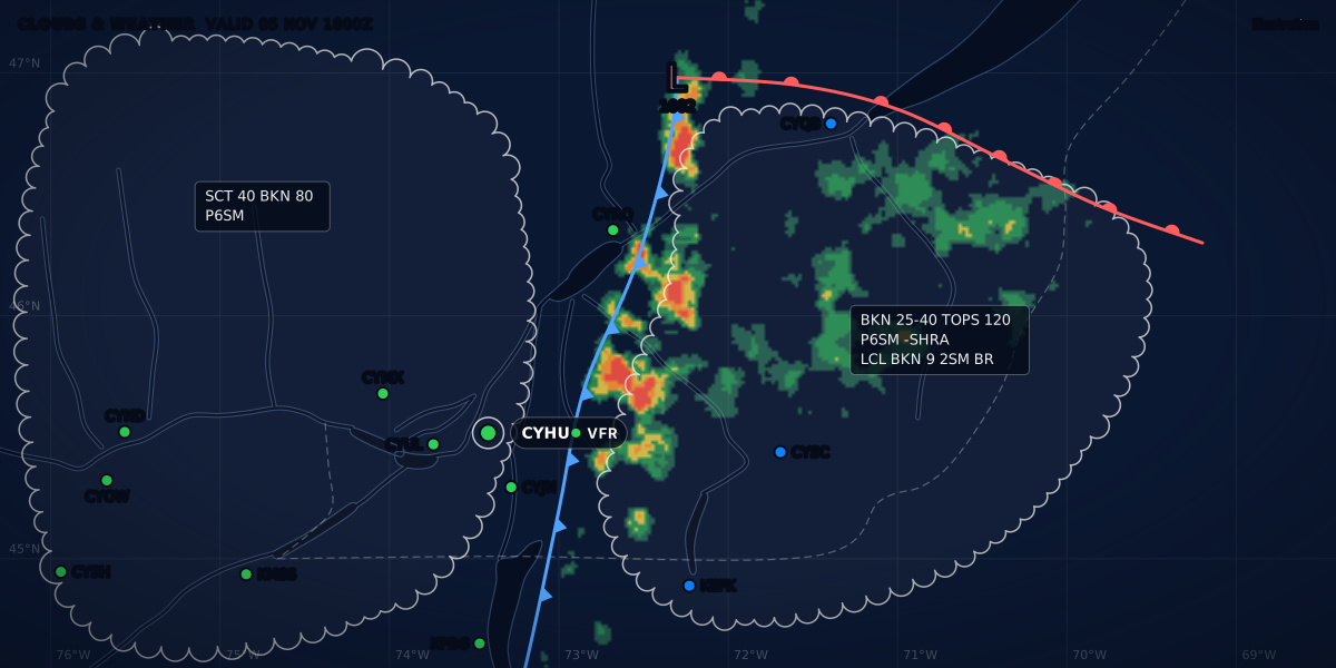
CLOUDS & WEATHER VALID 11 JUL 1800Z
Illustration
Turbulence in a small plane: plan smooth flights for passengers
What makes the air bumpy, the clues in a METAR and TAF, why summer afternoons are rougher, and how to brief your passengers on turbulence before engine start.
 Jp Valery
11 min read
Your passengers feel every bump. So a smooth-air check belongs in your preflight weather briefing, next to the go or no-go questions. On a summer day in southern Québec, one airport can give you a calm morning and a gusty afternoon. Here is one real day at Montréal / St-Hubert (CYHU), July 11, 2025:
| Local time (EDT) | CYHU report (main groups) | What it shows |
|---|---|---|
| 09:00 | 00000KT 9SM CLR 22/20 |
Calm wind, clear sky |
| 13:22 | 23004KT 140V250 9SM -RA BKN037 OVC100 27/20 |
Light rain |
| 16:28 | 26011G24KT 9SM BKN066 31/18 |
Gusts to 24 kt and a wind shift |
| 20:00 | 06005KT 9SM CLR 28/20 |
5 kt, 42 minutes before sunset |
| 00:00 | 00000KT 9SM FEW076 23/21 |
Calm again |
These are real reports from the Iowa Environmental Mesonet (IEM) archive: 13:00Z, 17:22Z and 20:28Z on July 11, then 00:00Z and 04:00Z on July 12, 2025. The table keeps the main groups only. Sunset (20:42 EDT) is computed with the NOAA solar equations.
This guide explains that pattern. It covers what makes the air bumpy, why the afternoon is rougher, which clues a METAR and a TAF give you, and how to brief your passengers before engine start.
Why smooth air matters to passengers
Turbulence is graded by what it does to the aircraft and to the people inside. Transport Canada’s reporting table gives both. Here is the cabin column (TC AIM MET 2.2.2, Table 2.2):
| Intensity | Reaction inside the aircraft |
|---|---|
| Light | “Occupants may feel a slight strain against seat belts or shoulder straps. Unsecured objects may be displaced slightly.” |
| Moderate | “Occupants feel definite strains against seat belts or shoulder straps. Unsecured objects are dislodged.” |
| Severe | “Occupants are forced violently against seat belts or shoulder straps. Unsecured objects are tossed about.” |
Even in light turbulence, your passengers may feel the belts pull, and loose objects may move. Plan to avoid it, or tell your passengers about it before you go. The full table, with the aircraft column and how to report turbulence, is in how to read a PIREP.
What makes the air bumpy
NAV CANADA’s weather manual for Ontario and Québec puts it in one line: “Turbulence is the direct result of wind shear” (LAKP Ontario-Quebec, p. 22). Wind shear is a change in wind speed or direction between two points (pp. 20-21). Near the ground, three things make it:
- Convection. The sun heats the ground, and the ground heats the air above it. That air becomes unstable and rises (p. 5). Updrafts and downdrafts “also induce shears” (p. 21). When unstable air is lifted, it gives “cumuliform clouds accompanied by showery weather and more turbulent conditions” (p. 33).
- Mechanical turbulence. The LAKP calls it “a form of shear induced when a rough surface disrupts the smooth wind flow” (pp. 21-22). Hills, buildings and trees break the wind into eddies (pp. 23, 133). How strong it is, and how deep the bumpy layer goes, depends on “the wind speed, the roughness of the obstruction and the stability of the air” (p. 22).
- Wind shear with height. Fronts and low-level jets can change the wind over a few hundred feet (pp. 21-23). Near a frontal low-level jet, the critical period for shear or turbulence is “one to three hours prior to a cold frontal passage” (p. 22).
The manual also lists local cases around Montréal. Pilots report occasional lee turbulence near Mount Rougemont, Mount Yamaska, Mount St-Hilaire and Mount Shefford (p. 132). At Sorel, pilots often meet moderate turbulence on final when the wind is over 15 kt (p. 133). I fly from CSB3, St-Mathieu-de-Beloeil. There, the manual says moderate turbulence is common on take-off and landing with westerly winds of 15 kt or more, likely from eddies off the buildings along the runway (p. 133). The LAKP dates from 2002. It describes the climate, not rules, and local details can change.
Why the afternoon is rougher and the evening calms
The LAKP states the daily cycle plainly (p. 20):
In a stable weather pattern, daytime winds are generally stronger and gustier than nighttime winds.
The reason is the sun. Its heating “sets up convective mixing”, which brings the stronger wind aloft down to the surface. The surface wind gets stronger and gusty. After sunset, the ground cools and an inversion forms. The mixing ends, “causing the surface winds to slacken” (p. 20).
Summer adds convective cloud. On a typical summer day, the sun makes the air unstable, and large convective cloud with showers or thundershowers forms “during the afternoon and evening”. After sunset, the air slowly becomes stable again, and the clouds dissipate (p. 5). Around Montréal, “showers develop in the early afternoon with the thunderstorms holding off until the late afternoon, around 4 p.m.” (p. 134).
The real day at CYHU followed that cycle. The wind was calm from 09:00 to 11:00. Light rain came and went from 13:22 to 14:00. Gusts came between 16:00 and 16:43, with a peak of 24 kt. The wind was 13 kt at 17:00, 8 kt at 18:00 and 5 kt at 20:00.
Two cautions:
- The cycle needs a stable pattern. Wind also comes from pressure differences: the larger the difference, the stronger the wind (p. 6). So a front or a deep low can bring wind at any hour.
- Calm at the surface is not calm aloft. The low-level nocturnal jet forms mainly on clear summer nights, typically 700 to 2,000 ft above the ground, usually at 20 to 40 kt. It starts to build just after sunset and peaks a couple of hours after midnight (p. 23). South of Montréal, pilots sometimes meet moderate shear and turbulence at night, 2,000 to 3,000 ft above the ground, with a warm front and a low-level jet (p. 134).
The clues in a METAR and TAF
A METAR does not report turbulence. A TAF does not forecast it. They give you wind, cloud and weather, and those are the clues.
- Gusts. A
Gin the wind group, as in26011G24KT, means the wind is not steady (read the wind group). In Canada, a METAR shows gusts when 5-second gusts exceed the mean by 5 kt or more and the peak reaches 15 kt or more (TC AIM MET 8.2). In the US, gusts are “rapid fluctuations in wind speed with a variation of 10 knots or more between peaks and lulls” (FMH-1 5.4.4). - Convective cloud.
TCU(towering cumulus) orCB(cumulonimbus) after a cloud layer, as inFEW045TCU. In Canada, the report adds the type to a layer when TCU or CB is the main cloud of that layer, and always names them in the remarks. An automatic station (AWOS) cannot report cloud types (TC AIM MET 8.2). In the US, the observer at a manual station adds CB or TCU to the layer (FMH-1 12.6.9). - Showers.
SHRAorTSRAin the weather group, or in a TEMPO or PROB group of the TAF. Unstable air, when lifted, tends to give convective cloud and showers (LAKP p. 5). - Wind shear. In Canada, a METAR can carry
WS RWYfor low-level wind shear within 1,500 ft of the ground on the take-off or approach path (TC AIM MET 8.2). A TAF can carry aWSgroup for non-convective shear within 1,500 ft above the aerodrome (MET 7.3). - Heat. A temperature that climbs fast on a sunny morning shows the sun heating the ground (LAKP p. 5). On the real day, CYHU went from 22 °C at 09:00 to 31 °C at 16:00.
Two rules hide clues. First, a Canadian TAF shows a gust only when it is forecast to exceed the mean by 10 kt or more (MET 7.3). So a TAF with no G can still come with METARs that show gusts. Second, CB is the only cloud type in a Canadian TAF (MET 7.3). So the TAF never shows TCU. For what TEMPO and PROB mean, see TAF change groups. To read the whole forecast, see how to read a TAF.
In Canada, the GFA comments box carries the standard line “CB TCU AND ACC IMPLY SIG TURB AND ICE” (TC AIM MET 4.9), and its icing and turbulence chart draws turbulence when moderate or severe turbulence is forecast (MET 4.12). How to read a GFA covers both charts.
A worked day at CYHU
Here is the morning report in full:
Real report, IEM archive, July 11, 2025, 13:00Z (09:00 EDT). The wind is calm and the sky is clear. AUTO means an automatic station made the report. For passengers, that is a good hour: no wind, and no convective cloud yet.
Here is the afternoon:
Real report, IEM archive, 20:28Z (16:28 EDT). The archive’s text leaves out the report type, but the archive files this report with the special reports, so it is shown here as a SPECI. It came between two hourly reports. Its remark WSHFT AT 2014Z reports a wind shift at 20:14Z, and a wind shift is one of the SPECI criteria (TC AIM MET 8.3.1(h)). The wind is 260° at 11 kt, gusting 24: the gust is 13 kt above the mean. Since 09:00, the temperature has gone from 22 to 31 °C.
CYHU’s reports name no cloud type, because its AWOS cannot report one. Montréal-Trudeau (CYUL), about 14 NM to the west, sent its reports without AUTO that day, and they name the cloud types:
Real report, IEM archive, 18:00Z (14:00 EDT). FEW045TCU is a few towering cumulus at 4,500 ft. CYUL reported TCU at 12:00, 13:00 and 14:00 EDT, and again at 18:00. For a field with no report of its own, see weather without a METAR.
The CYHU TAF of that day is not in the archive. A TAF for a day like this one could read (real-format example, not the TAF issued that day):
TAF CYHU 111140Z 1112/1212 VRB03KT P6SM SKC
     FM111700 24012G22KT P6SM SCT040 BKN080
     TEMPO 1117/1121 P6SM -SHRA BKN040 BKN080
     PROB30 1118/1121 3SM TSRA BKN035CB BKN080
     FM120000 24008KT P6SM FEW060
     FM120200 VRB03KT P6SM SKC
     RMK FCST BASED ON AUTO OBS. NXT FCST BY 111800Z
Read it for your passengers. The wind is light and variable until 17:00Z (13:00 EDT). From 17:00Z, it is 240° at 12 kt, gusting 22, with showers on and off until 21:00Z and a 30 percent chance of a thunderstorm from 18:00Z to 21:00Z. From 00:00Z (20:00 EDT), the wind drops to 8 kt, then becomes light and variable from 02:00Z. The smooth hours are before 13:00 and after 20:00 local time. The remark FCST BASED ON AUTO OBS says that the forecast comes in part from the AWOS reports (TC AIM MET 7.4).
A calm, humid day has a catch at each end. At 08:00 EDT, the same station reported an overcast layer at 400 ft. It was gone by 08:38. After sunset, haze cut the visibility from 21:05, down to 1 3/4 SM at 21:09, and it was back to 7 SM at 21:41. The LAKP notes that haze is more of a problem around Montréal than elsewhere in southwestern Québec, and that it makes navigation harder when you face a rising or setting sun (p. 134).
Every CYHU report from 08:38 to 21:00 was VFR, the gusty ones too. The category says nothing about the bumps: the category is a summary, the minimums are the law.
Brief the bumps before engine start
The rules already require a passenger briefing before take-off. In Canada, CARs 602.89 says the pilot-in-command must make sure passengers are briefed on, where they apply, the exits, safety belts and harnesses, seat positions, carry-on baggage, oxygen and any smoking ban. In the US, 14 CFR 91.107(a) requires a briefing on how to fasten and unfasten the belt, and a notice to fasten it before the aircraft moves on the surface, takes off or lands.
Add the turbulence talk to that briefing:
- Say when you expect bumps. Tell them when and for how long, so the first bump is no surprise.
- Keep the belts snug for the whole flight. Even in light turbulence, occupants “may feel a slight strain against seat belts” (TC AIM MET 2.2.2).
- Stow loose objects. Phones, bags and bottles may move slightly in light turbulence, and are “dislodged” in moderate turbulence (Table 2.2).
- Show the air vents. The A of the FAA’s SAFETY checklist starts with “Air vents (location and operation)” (FAA Safety Briefing, July/August 2014, p. 24).
- Ask them to speak up early. The same item lists “Action in case of any passenger discomfort”. The article adds: “at a minimum you want passengers to tell you right away if they feel uncomfortable” (p. 25).
For the rest of the briefing, safety-briefing.com has a free, printable passenger briefing built on the SAFETY items. Its before-flying section is worth sending to your passengers the evening before. safety-briefing.com is made by the same team as ClearMETAR.
When to postpone
Postpone, or move the flight to the morning or the evening, when the clues stack up: gusts in the METAR and the TAF, TCU or CB nearby, showers in a TEMPO or PROB group, a front due in the afternoon. An evening flight can end after dark, and each country has its own recency rule for passengers at night: see night currency.
Set your passenger limits before you look at the weather. A wind and a gust limit for flights with passengers, lower than your solo limits, keeps the decision simple. Personal minimums shows how to set them, and crosswind limits and gusts covers what gusts do on the runway. With ClearMETAR Pro, you set a wind and a gust limit. An amber line on the forecast timeline then marks the hours when the latest report or the TAF goes above them, so the calm hours stand out.
Sources
- The Weather of Ontario and Quebec (LAKP, GFA 33), 2002, pp. 5-6, 20-23, 33, 132-134, NAV CANADA
- TC AIM (TP 14371) 2026-2, MET 2.2.2 (Table 2.2), 4.9, 4.12, 7.3, 7.4, 8.2, 8.3.1, Transport Canada
- CARs 602.89 Passenger Briefings, Justice Laws Website
- 14 CFR 91.107 Use of safety belts, shoulder harnesses, and child restraint systems, eCFR
- Federal Meteorological Handbook No. 1 (FCM-H1-2019), 5.4.4, 12.6.9, Office of the Federal Coordinator for Meteorology
- FAA Safety Briefing, July/August 2014, pp. 24-25: S-A-F-E-T-Y Briefing, Federal Aviation Administration
- ASOS/METAR archive: CYHU and CYUL, July 11-12, 2025, Iowa Environmental Mesonet
Rules checked on
Common questions
What is the best time of day to fly a small plane with passengers?
On a summer day, often the morning, or the evening once the wind has dropped. In a stable weather pattern, daytime winds are "generally stronger and gustier than nighttime winds", and summer convection builds in the afternoon (NAV CANADA LAKP Ontario-Quebec, pp. 5 and 20).
What should I tell passengers about turbulence?
Tell them when you expect bumps, to keep their belts snug and loose objects stowed, and to tell you right away if they feel uncomfortable. Even in light turbulence, occupants "may feel a slight strain against seat belts or shoulder straps" (TC AIM MET 2.2.2, Table 2.2).
Does a METAR report turbulence?
No. It gives clues: a gust group, TCU or CB on a cloud layer, and showers (TC AIM MET 8.2). Pilots report the turbulence itself, in PIREPs (TC AIM MET 2.2.2).
Let the app do the decoding.
ClearMETAR turns every METAR and TAF into one plain sentence. Free on iPhone.