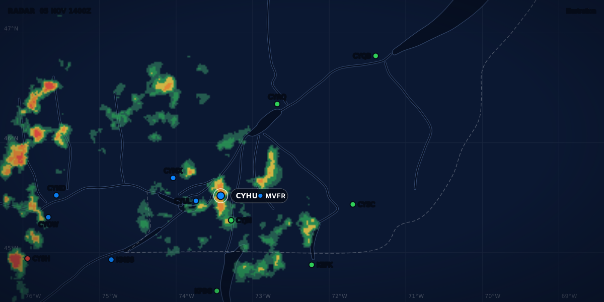
RADAR 06 NOV 1500Z
Illustration
METAR weather codes and abbreviations: the full list
Every METAR weather code, plus the report-body abbreviations: RA, BR, FG, VCSH, +FC, FEW to OVC, CAVOK, AUTO, NOSIG, and where Canada, the US and ICAO differ.
 Jp Valery
17 min read
A METAR is a string of short codes: -SHRA, BKN025, VCTS, CAVOK. This page lists the codes you can meet in the body of a METAR or SPECI, with the meaning and the rule behind each one. If reports are new to you, start with how to read a METAR, group by group. That guide explains the order of the groups. Come back here when a code stops you.
Canada, the United States and Europe use the same international code, with national differences. The tables show where the rules differ. The rules come from the US Federal Meteorological Handbook No. 1 (FMH-1), the Canadian TC AIM MET and MANOBS, and Météo-France’s Guide aviation 2024 for the ICAO forms used in France.
Here is a real-format example (written for this guide, not a real report) from Montréal-Trudeau (CYUL), with the weather codes highlighted:
-SHRA is light rain showers and BR is mist. The chip shows the flight category, MVFR here. The flight category is a summary of the ceiling and the visibility. It is not the legal VFR minimum.
How to use this list
- The groups always come in the same order. A group that does not apply is left out (FMH-1 12.5, TC AIM MET 8.1).
- Search the page for the code in front of you (Ctrl+F or ⌘F).
- Everything after
RMKis a remark. Remarks have their own guide. - A TAF uses the same weather codes, with the same meaning (TC AIM MET 7.2), plus forecast words. One exception in Canada:
VC(see VC by country below). See how to read a TAF. - In the ClearMETAR app, tap a group of a METAR or TAF to see its meaning in plain words.
Report words
| Code | Meaning | Where it differs |
|---|---|---|
METAR |
Routine report, normally on the hour | When SPECI criteria are met at the time of the routine report, the US sends a METAR (FMH-1 12.6.1). |
SPECI |
Special report, issued between routine reports when the weather changes a lot | The triggers differ by country: see what triggers a SPECI. |
CYUL |
Station indicator (ICAO) | Canadian indicators start with C, then W, Y or Z (TC AIM MET 8.2). |
061500Z |
Day of the month and time | Always UTC: the Z (FMH-1 12.6.3). |
AUTO |
Fully automated report, no human observer | In Canada, AUTO and a correction can appear together: AUTO CCA (TC AIM MET 8.2; MANOBS 11.2.1). |
COR |
Corrected report (US, France) | In the US, COR takes the place of AUTO (FMH-1 12.6.4). |
CCA, CCB |
Corrected report (Canada): first, second correction | MANOBS 11.2.2.5. |
RMK |
Remarks follow | In Canada, the sea-level pressure is the last mandatory remark (TC AIM MET 8.2). |
= |
End of message | No other meaning (TC AIM MET 8.2). |
Missing data looks different too. A US report leaves out a group it cannot observe (FMH-1 12.5). Canadian and French reports can show slashes instead: ///// for a missing wind (TC AIM MET Table 8.3; Météo-France p. 16), //// for a missing visibility and Q//// for a missing QNH (Météo-France pp. 16-17).
Wind, visibility and RVR codes
Wind
The direction is in degrees true, in tens of degrees (FMH-1 5.5.1 and 12.6.5; TC AIM MET 8.2). Whether a spoken wind is true or magnetic is another question, answered in the crosswind guide: true and magnetic wind.
| Code | Meaning | Where it differs |
|---|---|---|
KT, MPS, KMH |
Knots, metres per second, kilometres per hour | Canada and the US use knots (TC AIM MET 8.2; FMH-1 12.6.5). |
22014KT |
Mean wind 220° at 14 kt | Canada and the US: 2-minute mean (TC AIM MET 8.2; FMH-1 5.4.3). France: 10-minute mean (Météo-France p. 16). |
G24 |
Gusts to 24 kt | US: speed varies 10 kt or more between peaks and lulls (FMH-1 5.4.4). Canada: gusts 5 kt or more above the mean, peak 15 kt or more (TC AIM MET 8.2). France: gusts 10 kt above the mean (Météo-France p. 16). |
VRB02KT |
Variable direction, 2 kt | US: allowed at 6 kt or less (FMH-1 12.6.5). Canada: below 3 kt, or when the direction varies 180° or more (TC AIM MET 8.2). France: below 3 kt with 60° or more of variation, or more than 180° of variation (Météo-France p. 16). |
180V240 |
Direction varies from 180° to 240°, clockwise | US: above 6 kt, 60° or more (FMH-1 5.4.2, 12.6.5). Canada: 60° to less than 180°, mean above 3 kt (TC AIM MET 8.2). |
00000KT |
Calm | Same everywhere (FMH-1 12.6.5; TC AIM MET 8.2). |
Visibility
| Code | Meaning | Where it differs |
|---|---|---|
15SM |
15 statute miles | Canada and the US (TC AIM MET 8.2; FMH-1 12.6.6). A NAV CANADA AWOS reports up to 9 SM (TC AIM MET Table 8.3). |
1 1/2SM |
1 1/2 SM | A space between the whole number and the fraction (FMH-1 12.6.6). |
M1/4SM |
Less than 1/4 SM | US automated stations (FMH-1 12.6.6). |
10SM |
10 SM | The highest value on the US automated list (FMH-1 Table 12-1). |
P6SM |
More than 6 SM | A TAF value (TC AIM MET 7.3). It is not on the US METAR list (FMH-1 Table 12-1). |
9999 |
10 km or more | Reports in metres, as in France (Météo-France p. 16). |
0800 |
800 m | Four digits, in metres (Météo-France p. 16). |
3500SE |
3,500 m toward the southeast | France: a lower visibility in one direction, added when it is below 1,500 m, or below half the prevailing visibility and below 5,000 m (Météo-France p. 16). Canada puts a lower sector visibility in the remarks instead: VIS NW 3/8 (TC AIM MET 8.2). |
Runway visual range (RVR)
| Code | Meaning | Source |
|---|---|---|
R01L/0800FT |
Runway 01L, RVR 800 ft | FMH-1 12.6.7 |
R01L/0600V1000FT |
Varies from 600 to 1,000 ft | FMH-1 12.6.7 |
R01L/M0600FT |
Less than 600 ft, the lowest value the system reports | FMH-1 12.6.7 |
R27/P6000FT |
More than 6,000 ft, the highest value | FMH-1 12.6.7 |
R01L/0800VP6000FT |
Varies from 800 ft to more than 6,000 ft | The two rules above, combined (FMH-1 12.6.7(b) and (d)) |
R06L/1000V2400FT/U |
Varies from 1,000 to 2,400 ft, trend up | Canada adds a trend: /U up, /D down, /N no change, for a change of 300 ft or more (TC AIM MET 8.2). |
R33R/0150 |
Runway 33R, RVR 150 m | France: metres, no unit; trend U, D or N for a change of 100 m or more (Météo-France p. 16). |
Canada includes RVR when the prevailing visibility is 1 SM or less, or the RVR is 6,000 ft or less (TC AIM MET 8.2). The US format has no trend letter (FMH-1 12.6.7).
Present weather: how a group is built
A weather group is written in a fixed order: intensity or proximity, then a descriptor, then the weather itself (FMH-1 Table 12-2, note 1; MANOBS 11.2.2.13). So heavy rain showers is +SHRA, never SH+RA.
- Intensity.
-light, no sign moderate,+heavy. With more than one type of precipitation in one group, the sign is the intensity of all of them together (FMH-1 12.6.8; TC AIM MET 8.2). - One descriptor per group (FMH-1 12.6.8; TC AIM MET 8.2). That is why
TSandSHnever appear together. - Up to three precipitation types in one group, the dominant one first:
TSSNGS(FMH-1 12.6.8). - Separate groups for each type of weather. A US report has three weather groups at most (FMH-1 12.6.8). Canada uses as many as it needs (TC AIM MET 8.2).
- In Canada, freezing precipitation is always a group of its own, and so is an obscuration that comes with precipitation (TC AIM MET 8.2).
- No sign on ice crystals, hail and unknown precipitation in the US, nor on
BLSN,BLDUandBLSA(FMH-1 12.6.8).
| Group | Reads as | Source |
|---|---|---|
-SHRA |
Light rain showers | FMH-1 Table 12-2 |
+TSRA |
Thunderstorm with heavy rain (the sign is for the rain) | FMH-1 12.6.8 |
TSSNGS |
Thunderstorm with snow and snow pellets | FMH-1 12.6.8 |
-SHRAGR |
Light showers of rain and hail | TC AIM MET 8.2 |
-FZDZ |
Light freezing drizzle | FMH-1 12.6.8 |
-RA BR |
Light rain, and mist: two groups | TC AIM MET 8.2 |
SN BLSN |
Snow falling, and blowing snow: two groups | TC AIM MET 8.2; FMH-1 12.6.8 |
VCSH |
Showers in the vicinity; the type and intensity are not given | FMH-1 12.6.8; TC AIM MET 8.2 |
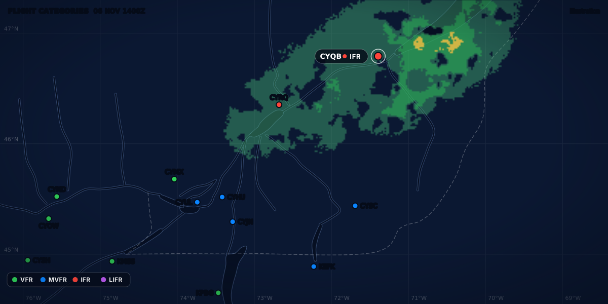
Here is a real-format example (written for this guide) from Québec / Jean Lesage (CYQB) with snow and blowing snow:
The weather codes
Precipitation
| Code | Meaning | Notes |
|---|---|---|
DZ |
Drizzle | Fine drops, less than 0.5 mm, very close together (FMH-1 8.3.1). A NAV CANADA AWOS does not report drizzle: it usually reports rain or UP (TC AIM MET 8.4.3). |
RA |
Rain | |
SN |
Snow | |
SG |
Snow grains | Very small white, opaque grains of ice (FMH-1 8.3.1). |
IC |
Ice crystals (diamond dust) | Not icing. Canada reports it at 6 SM or less (TC AIM MET Table 8.1). |
PL |
Ice pellets | Frozen raindrops, or largely melted and refrozen snowflakes, 5 mm or less (FMH-1 8.3.1). |
GR |
Hail | In the US, small hail is hail too. The size goes in the remarks: GR 1 3/4 (FMH-1 12.7.1(n)). |
GS |
US: snow pellets. Canada: small hail and/or snow pellets | FMH-1 Table 12-2; MANOBS Table 11-1. See the mix-ups below. |
UP |
Unknown precipitation | Automated stations only (FMH-1 12.6.8; TC AIM MET Table 8.1). |
Obscurations
| Code | Meaning | Notes |
|---|---|---|
BR |
Mist | US: visibility from 5/8 SM to less than 7 SM (FMH-1 8.3.2). Canada: 5/8 SM or more (TC AIM MET Table 8.1). France: 1 to 5 km (Météo-France p. 28). |
FG |
Fog | Less than 5/8 SM in Canada and the US (TC AIM MET Table 8.1; FMH-1 8.3.2); less than 1 km in France (Météo-France p. 28). 5/8 SM is 1,006 m, so the limit is about the same. |
FU |
Smoke | Canada: 6 SM or less. |
VA |
Volcanic ash | Canada: at any visibility. The US always reports it (FMH-1 12.6.8). |
DU |
Widespread dust | Canada: 6 SM or less. |
SA |
Sand | Canada: 6 SM or less. |
HZ |
Haze | Dry particles, too small to see (FMH-1 8.3.2). Canada: 6 SM or less. |
PY |
Spray | US only, and only as BLPY (FMH-1 12.6.8). It is not in the Canadian or Météo-France tables. |
The Canadian limits are from TC AIM MET Table 8.1. In the US, an obscuration goes in the body when the visibility is less than 7 SM or it matters to operations, with a few exceptions such as volcanic ash and the fog descriptors (FMH-1 12.6.8). Canada generally reports one at 6 SM or less (TC AIM MET 8.2). Mist and fog have their own guide, with the fog types behind each code.
Other phenomena
| Code | Meaning | Notes |
|---|---|---|
PO |
Dust or sand whirls (dust devils) | |
SQ |
Squalls | US: the wind rises by at least 16 kt and stays at 22 kt or more for at least a minute (FMH-1 8.3.3). A NAV CANADA AWOS does not report squalls (TC AIM MET Table 8.3). |
FC |
Funnel cloud | A rotating column of air that does not touch the ground (FMH-1 8.3.3). |
+FC |
Tornado or waterspout | FMH-1 12.6.8; TC AIM MET Table 8.1. Canada also writes it out in the remarks (TC AIM MET 8.2). |
SS |
Sandstorm | Canada: less than 5/8 SM, and +SS less than 5/16 SM (TC AIM MET Table 8.1). US: moderate or heavy only (FMH-1 12.6.8). |
DS |
Duststorm | Same limits as SS. |
Descriptors
| Code | Meaning | Used with |
|---|---|---|
MI |
Shallow | Fog only: MIFG. US: less than 6 ft deep (FMH-1 8.4.1). |
BC |
Patches | Fog only: BCFG. |
PR |
Partial | Fog only: PRFG, covering part of the aerodrome (MANOBS Table 11-1). |
DR |
Low drifting | Dust, sand or snow raised by the wind to less than 2 m in Canada (TC AIM MET 8.2) or 6 ft in the US (FMH-1 8.4.1). |
BL |
Blowing | The same, raised to 2 m or 6 ft or more. The US also has BLPY. |
SH |
Shower(s) | US: with rain, snow, ice pellets, snow pellets or hail (FMH-1 12.6.8). Canada: rain, snow, hail or snow pellets (TC AIM MET 8.2). |
TS |
Thunderstorm | Alone or with precipitation. It ends 15 minutes after the last thunder in Canada (TC AIM MET 8.2), or the last thunder or lightning in the US (FMH-1 8.5.4). |
FZ |
Freezing | Only with fog, drizzle or rain: FZFG, FZDZ, FZRA (FMH-1 12.6.8; TC AIM MET 8.2). |
Mist (BR) never takes a descriptor (FMH-1 12.6.8). What MIFG, BCFG, PRFG and FZFG mean on the field, and why they can come with a high visibility, is in fog types for pilots.
2 m is about 6.6 ft, so the Canadian and US limits for drifting and blowing are almost the same.
Cloud cover
| Code | Meaning | Notes |
|---|---|---|
FEW |
Few: 1/8 to 2/8 of the sky | Less than 1/8 is also FEW (FMH-1 Table 12-3; TC AIM MET Table 8.2). |
SCT |
Scattered: 3/8 to 4/8 | |
BKN |
Broken: 5/8 to 7/8 | |
OVC |
Overcast: 8/8 | |
VV |
Vertical visibility | The sky is obscured. VV002 is a vertical visibility of 200 ft (TC AIM MET 8.2; FMH-1 12.6.9). |
SKC |
Sky clear | An observer saw no cloud (FMH-1 12.6.9; TC AIM MET Table 8.2). |
CLR |
Clear | An automated station detected no cloud up to its limit: at or below 12,000 ft in the US (FMH-1 12.6.9), below 25,000 ft for a NAV CANADA AWOS, 10,000 ft for some private AWOS (TC AIM MET 8.2 and Table 8.3). |
NSC |
No significant cloud | No cloud below the CAVOK height (1,500 m or 5,000 ft, or the minimum sector altitude if that is higher), no CB, no TCU, and the report is not CAVOK (Météo-France p. 17). |
NCD |
No cloud detected | Automated stations in France (Météo-France p. 17) and some Canadian AWOS, including DND sites (TC AIM MET 8.4.3). |
CB |
Cumulonimbus | Added to its layer: BKN035CB. |
TCU |
Towering cumulus | SCT025TCU. |
/// |
Not detected | France, automated: SCT005/// is a layer of unknown type; ///CB is a CB whose amount and height are not known (Météo-France p. 17). |
Heights are in hundreds of feet above the station: BKN025 is 2,500 ft. Canada reports them in steps of 100 ft up to 10,000 ft, then 1,000 ft (TC AIM MET 8.2). The US uses 100 ft up to 5,000 ft, 500 ft up to 10,000 ft, then 1,000 ft (FMH-1 Table 12-4).
The amounts are summation amounts: each layer includes the layers below it (FMH-1 Table 12-3; TC AIM MET 8.2). In the US, only manual stations add CB and TCU (FMH-1 12.6.9). A Canadian AWOS cannot report cloud types (TC AIM MET 8.2).
The ceiling is the lowest BKN, OVC or VV. The definitions and the edge cases are in what is a ceiling.
ICAO-only words
The US METAR format (FMH-1 12.3) and the Canadian one (MANOBS 11.2.1) have no CAVOK, NSC, trend or RE group. You meet these words in European reports. Canadian TAFs may not use CAVOK either (TC AIM MET 7.3).
| Code | Meaning | Source |
|---|---|---|
CAVOK |
Ceiling and visibility OK: visibility 10 km or more, no cloud below 1,500 m (5,000 ft) or the minimum sector altitude, whichever is higher, no CB or TCU, and no significant weather. It replaces the visibility, weather and cloud groups. | Météo-France p. 17 |
NOSIG |
No significant change expected in the 2 hours after the observation | Météo-France p. 18 |
BECMG, TEMPO |
Trend groups: a change forecast for the 2 hours after the observation. A TEMPO fluctuation lasts less than an hour and covers less than half of the period. |
Météo-France p. 18 |
FM, TL, AT |
Trend times: from, until, at. TEMPO FM1130 TL1230 OVC006, BECMG AT 1200 33010KT |
Météo-France p. 18 |
RE |
Recent weather, after the body: RERA, REFZRA, RETS, RESHSN, REBLSN |
Météo-France pp. 17-18 |
Q1021 |
QNH 1021 hPa, rounded down to the whole hectopascal | Météo-France p. 17 |
WS R27, WS ALL RWY |
Wind shear on runway 27, or on all runways | Météo-France p. 18. Canada uses it too: WS RWY 09 (TC AIM MET 8.2). |
BECMG and TEMPO mean the same as in a TAF: see TAF change groups.
A real-format example (written for this guide) from Toussus-le-Noble (LFPN), near Paris:
CAVOK does not mean a clear sky. There can be cloud above 5,000 ft, or above the minimum sector altitude where that is higher.
And a real-format example (written for this guide) from Paris-Orly (LFPO): mist now, and fog forecast on and off:
BR with 1,500 m is mist (1 to 5 km). TEMPO 0500 FG forecasts fog, with 500 m, for parts of the next 2 hours.
VC by country
VC means in the vicinity: near the station, but not at it. The distance is not the same everywhere.
| Where | VC means | Source |
|---|---|---|
| United States | 5 to 10 SM from the station. Within 5 SM is “at the station”. Beyond 10 SM is distant: DSNT, in the remarks. One exception: precipitation within 10 SM that is not at the station is VCSH. |
FMH-1 8.4.1, 8.5, 8.5.1, 12.7 |
| Canada | Within 5 SM, but not at the station. In a Canadian TAF, VC is 5 to 10 NM from the centre of the runway complex. |
TC AIM MET 8.2, 7.3 |
| France | 8 to 16 km from the aerodrome reference point (about 5 to 10 SM) | Météo-France p. 16 |
VC goes only with some codes. US: TS, FG, SH, PO, BLDU, BLSA, BLSN, SS, DS (FMH-1 12.6.8). Canada adds FC and +FC (TC AIM MET 8.2). VC never takes an intensity sign (FMH-1 12.6.8). With VCSH, the type of precipitation is not given (FMH-1 12.6.8; TC AIM MET 8.2).
Automated stations report thunderstorms from lightning detection, with their own distances:
| Station | TS |
VCTS |
Farther, in the remarks |
|---|---|---|---|
| US automated | Within 5 NM | 5 to 10 NM | LTG DSNT and the direction, beyond 10 and less than 30 NM |
| NAV CANADA AWOS | 6 SM or less | More than 6 to 10 SM | LTNG DIST and the direction, more than 10 to 30 SM; LTNG DIST ALL QUADS in four or more octants |
Sources: FMH-1 12.7.1(j); TC AIM MET 8.4.3. 5 NM is 5.75 SM, so the inner line is about the same (5.75 SM against 6 SM). The US outer lines are a little farther out: 10 NM is 11.5 SM and 30 NM is 34.5 SM, against 10 SM and 30 SM in Canada. An AWOS outside the Canadian Lightning Detection Network cannot report thunderstorms or lightning at all (TC AIM MET 1.2.3).
A real-format example (written for this guide) from Plattsburgh (KPBG), an automated US report with lightning 5 to 10 NM away:
Automated reports (AUTO)
An AUTO report comes from sensors only. It can only contain the codes its sensors know. So a code that is not in an AUTO report may simply be one the station cannot report.
- NAV CANADA AWOS (TC AIM MET Table 8.3 and 8.4.3): weather
RA,FZRA,SNandUP; obscurationsFG,FZFG,BR,BLSNandHZ;TSwith lightning remarks. No drizzle: it usually shows asRAorUP, and freezing drizzle asFZRAorFZUP. No squalls, noVCother than thunderstorms, no cloud types. - US automated stations (FMH-1 12.6.6, 12.6.8, 12.6.9):
UPfor an unknown type,M1/4SMfor less than 1/4 SM,CLRfor no cloud at or below 12,000 ft, and noCBorTCU(only manual stations add them). - France, METAR AUTO (Météo-France p. 16): the only weather codes are
DZ,FG,BCFG,BR,PL,RA,SN,TS,HZ,FZFG,SHRA,SHSN,FZRA,FZDZandVCTS.
A real-format example (written for this guide) from Montréal / St-Hubert (CYHU), an AWOS report in freezing fog:
Common mix-ups
ICis not icing. In the weather group, it is ice crystals (FMH-1 Table 12-2). In US remarks,ICafterLTG, as inLTGICCG, is in-cloud lightning (FMH-1 Table 12-5). FMH-1 Appendix B gives both meanings.GSis not the same size in both countries. In the US,GSis snow pellets, and small hail is reported as hail,GR(FMH-1 8.3.1, 12.7.1(n)). In Canada,GScovers small hail too:SHGScan be small hail under 5 mm, with the size in the remarks (TC AIM MET 8.2).UPonly comes from a machine (FMH-1 12.6.8; TC AIM MET Table 8.1). It means the sensor saw precipitation but could not tell the type (FMH-1 8.3.1).MandP.Mis minus in the temperature group (M03) and “less than” in visibility and RVR (M1/4SM).Pis “more than” (P6SM,P6000FT) (FMH-1 Appendix B).BRorHZ. Mist is water droplets; haze is dry particles (FMH-1 8.3.2). French readers:BRis brume andHZis brume sèche (Météo-France p. 18).SKCorCLR.SKCmeans an observer saw no cloud.CLRmeans a sensor found none below its limit. Cloud can still be above it.CCAis not a cloud. After the time, it is a Canadian correction (TC AIM MET 8.2).CCis cirrocumulus in Canadian cloud remarks (TC AIM MET 8.2), and cloud-to-cloud lightning in US remarks (FMH-1 Table 12-5).DSNTorDIST. The US writesLTG DSNT; a NAV CANADA AWOS writesLTNG DIST(FMH-1 12.7.1; TC AIM MET 8.4.3).
Sources
- Federal Meteorological Handbook No. 1 (FCM-H1-2019): chapters 5, 8 and 12, Appendix B, Office of the Federal Coordinator for Meteorological Services and Supporting Research
- TC AIM (TP 14371) 2026-2, MET 1.2.3, 7.2, 7.3, 8.1 to 8.4, Transport Canada
- MANOBS, 8th edition, Amendment 3 (September 2026), chapter 11 (METAR and SPECI code), Environment and Climate Change Canada
- Guide aviation 2024: METAR and SPECI (pp. 16-18), glossary (p. 28), Météo-France
Rules checked on
Common questions
What does VC mean in a METAR?
VC means in the vicinity: near the station, but not at it. The distance depends on the country: 5 to 10 SM in the US (FMH-1 8.5), within 5 SM in Canada (TC AIM MET 8.2) and 8 to 16 km in France (Météo-France Guide aviation 2024, p. 16).
What does CAVOK mean?
Ceiling and visibility OK: visibility 10 km or more, no cloud below 1,500 m (5,000 ft) or the minimum sector altitude, whichever is higher, no CB or TCU, and no significant weather (Météo-France Guide aviation 2024, p. 17). It replaces the visibility, weather and cloud groups, and the US and Canadian METAR formats do not use it (FMH-1 12.3, MANOBS 11.2.1).
What does NOSIG mean?
No significant change is expected in the 2 hours after the observation (Météo-France Guide aviation 2024, p. 18). It is a trend word of ICAO METARs; the US and Canadian METAR formats have no trend group (FMH-1 12.3, MANOBS 11.2.1).
What does +FC mean?
+FC is a tornado or a waterspout, and FC alone is a funnel cloud that does not touch the ground (FMH-1 12.6.8(e)(2) and 8.3.3). Canada uses the same two codes (TC AIM MET Table 8.1).
Is IC in a METAR icing?
No. In the weather group, IC is ice crystals, also called diamond dust (FMH-1 Table 12-2 and 8.3.1); in US remarks, IC after LTG means in-cloud lightning (FMH-1 Table 12-5).
Let the app do the decoding.
ClearMETAR turns every METAR and TAF into one plain sentence. Free on iPhone.