CLOUDS & WEATHER VALID 06 NOV 1500Z
Illustration
VFR cruising altitudes in Canada, the US and Europe
Above 3,000 ft AGL, VFR flies odd or even thousands plus 500 by magnetic track. Canada (true track in the north), the US and Europe, with worked examples.
 Jp Valery
12 min read
Short answer
More than 3,000 ft above the ground, a VFR flight in level cruise flies an altitude that matches its direction. On a magnetic track from 000° to 179°, you fly odd thousands plus 500 ft: 3,500, 5,500, 7,500. From 180° to 359°, you fly even thousands plus 500 ft: 4,500, 6,500, 8,500. You may also see it called the hemispheric or semicircular rule.
Canada, the United States and Europe use the same numbers. They differ at the edges: which north you use, what counts as the threshold, and how high VFR may go. This rule is one part of the VFR rules; the VFR vs IFR guide shows the others.
| Canada | United States | Europe (SERA) | |
|---|---|---|---|
| Rule | CARs 602.34 | 14 CFR 91.159 | SERA.5005(g), Appendix 3 |
| Applies to VFR in level cruise | “at more than 3,000 feet AGL” | “more than 3,000 feet above the surface” | “above 900 m (3000 ft) from the ground or water”, or a higher datum set by the authority |
| Direction | Magnetic track; true track in the Northern Domestic Airspace | Magnetic course | Magnetic track (grid track in polar areas above 70°) |
| 000° to 179° | Odd thousands + 500 ft | Odd thousands + 500 ft MSL | FL 035 (3,500 ft), FL 055, FL 075 … |
| 180° to 359° | Even thousands + 500 ft | Even thousands + 500 ft MSL | FL 045 (4,500 ft), FL 065, FL 085 … |
| Upper end | Controlled airspace from 18,000 ft ASL to FL 600 is IFR | Above 18,000 ft MSL, ATC assigns the level | VFR above FL 195 only where the State allows it |
When the rule applies
All three rules need three things at the same time:
- You fly VFR. IFR has its own altitudes (see IFR cruising altitudes in brief below).
- You are in level cruising flight. Climbs and descents do not count. The US rule also excepts turns and holding patterns of 2 minutes or less (91.159).
- You are more than 3,000 ft above the ground (or the water, in SERA).
Below that height, none of the three rules sets an altitude for your direction. The threshold is a height above the ground, but the altitudes are above sea level. At Burlington, Vermont (KBTV), the field elevation is 335 ft (FAA Chart Supplement), so 3,500 ft is only 3,165 ft above the field. Over higher ground, the same altitude can be less than 3,000 ft above the terrain. There, the rule does not apply.
ATC can give you another altitude. CARs 602.34(2) applies “unless the pilot-in-command is assigned another altitude or flight level by an air traffic control unit”. 14 CFR 91.159 says “unless otherwise authorized by ATC”, and SERA.5005(g) starts with “Except where otherwise indicated in air traffic control clearances or specified by the competent authority”.
Track, not heading; magnetic, not true
Track. The Canadian and European rules use the track. The Designated Airspace Handbook (DAH) defines it as “the projection on the earth’s surface of the path of an aircraft”. So the track is your path over the ground. The US rule says “magnetic course”. None of the three uses the heading. In a crosswind, your heading and your track differ, and the altitude goes with the track.
Magnetic. A course that you measure against a meridian is a true course. The rule wants the magnetic one, so you apply the magnetic variation. NOAA counts the variation (declination) as positive east and negative west, and gives true = magnetic + declination (NOAA). So with a west variation, as around Montréal, magnetic = true + variation. The crosswind guide does the same conversion for the wind.
Near Montréal, the variation is about 14° W. On a southbound route, that can change the answer: from St-Hubert to Burlington, the true course is 170°, but the magnetic track is 183°. True says odd, magnetic says even, and magnetic is the rule. The worked examples show the numbers.
Canada (CARs 602.34)
CARs 602.34(1) sets the reference: “the magnetic track, in the Southern Domestic Airspace” and “the true track, in the Northern Domestic Airspace”. 602.34(2) applies the table of the section when the aircraft is in level cruising flight “at more than 3,000 feet AGL, in VFR flight” or “in IFR flight”. 602.34(3) exempts some aerial survey and mapping flights.
The TC AIM gives the table in a shorter form (RAC 2.3.1, Table 2.1). Below 18,000 ft ASL:
| Below 18,000 ft ASL | Track 000° to 179° | Track 180° to 359° |
|---|---|---|
| VFR | Odd thousands plus 500 ft: 3,500, 5,500, 7,500 | Even thousands plus 500 ft: 4,500, 6,500, 8,500 |
| IFR and CVFR | Odd thousands: 1,000, 3,000, 5,000 | Even thousands: 2,000, 4,000, 6,000 |
Source: TC AIM RAC 2.3.1, Table 2.1. RAC 2.3.1 also accepts an altitude assigned “by written authority from the Minister”.
The north uses the true track. “In the NDA, runway heading is given in degrees true, and true track is used to determine cruising altitude or flight level for direction of flight in lieu of magnetic track” (TC AIM RAC 2.2.1). The reason is the weak horizontal magnetic field near the magnetic North Pole and its effect on compasses. The DAH glossary draws the boundary. Near Yellowknife and Iqaluit, the line curves around the north side of each airport, on an arc of 50 miles around the Yellowknife VOR and of 40 miles around the Frobay NDB. So both airports stay in the Southern Domestic Airspace. That is our reading of the DAH text; RAC 2.2.1, Figure 2.1 has the map.
Flight levels in the north. The altimeter setting region is “all low level airspace within the SDA”, and the standard pressure region is all the rest of Canadian domestic airspace (DAH glossary). In the standard pressure region, Table 2.1 says to fly the corresponding flight levels. The altimeter setting guide explains the two regions.
CVFR flies the IFR column. RAC 2.3.1 lists CVFR flights on their own, with no 3,000 ft AGL condition, and Table 2.1 puts them in the “IFR and CVFR” column: whole thousands. Low-level controlled airspace above 12,500 ft ASL, or at and above the MEA if that is higher, is Class B, and VFR flights there are controlled VFR flights (RAC 2.8.2). So in that Class B airspace, a VFR flight cruises at whole thousands, not at thousands plus 500. That is our reading of RAC 2.3.1 and 2.8.2 together; the airspace classes guide explains Class B.
The top. In controlled airspace from 18,000 ft ASL to FL 600, you fly IFR “unless otherwise authorized in writing by the Minister” (RAC 2.3.1(d)).
United States (14 CFR 91.159)
“Except while holding in a holding pattern of 2 minutes or less, or while turning, each person operating an aircraft under VFR in level cruising flight more than 3,000 feet above the surface shall maintain the appropriate altitude or flight level prescribed below, unless otherwise authorized by ATC” (14 CFR 91.159). Below 18,000 ft MSL:
- “On a magnetic course of zero degrees through 179 degrees, any odd thousand foot MSL altitude + 500 feet (such as 3,500, 5,500, or 7,500)” (91.159(a)(1)).
- “On a magnetic course of 180 degrees through 359 degrees, any even thousand foot MSL altitude + 500 feet (such as 4,500, 6,500, or 8,500)” (91.159(a)(2)).
Above 18,000 ft MSL, the rule gives no table: “maintain the altitude or flight level assigned by ATC” (91.159(b)). The airspace classes guide explains Class A.
An IFR flight cleared for “VFR conditions on-top” also flies the 91.159 altitudes (14 CFR 91.179(a)). The VFR over the top guide explains what that clearance is.
Europe and France (SERA.5005(g))
SERA.5005(g): “VFR flights in level cruising flight when operated above 900 m (3000 ft) from the ground or water, or a higher datum as specified by the competent authority, shall be conducted at a cruising level appropriate to the track as specified in the table of cruising levels in Appendix 3.”
The VFR part of the Appendix 3 table:
| Track | VFR levels |
|---|---|
| 000° to 179° | FL 035 (3,500 ft), FL 055, FL 075 … up to FL 275 |
| 180° to 359° | FL 045 (4,500 ft), FL 065, FL 085 … up to FL 285 |
The track is magnetic. In polar areas at latitudes higher than 70°, and in extensions that the authorities prescribe, it is a grid track (Appendix 3, note 1).
Altitude or flight level. SERA.3110 says the cruising level is a flight level at or above the lowest usable flight level, or above the transition altitude. Below the lowest usable flight level, or at and below the transition altitude, it is an altitude. So FL 045 in the table is 4,500 ft when you fly at or below the transition altitude.
How high. VFR flights shall not fly above FL 195, unless the State has set up an airspace reservation for them, or the ATS unit has authorized VFR up to FL 285 (SERA.5005(d)).
France. AIP France ENR 1.2.7 repeats the rule for VFR flights “à une hauteur supérieure à 900 m (3 000 ft) au-dessus du sol ou de l’eau”, with the same table (FL 035 to FL 275 and FL 045 to FL 285). ENR 1.7 adds that “les vols VFR sont interdits au-dessus du niveau 195, sauf autorisation de l’autorité ATS” (1.7.5). The 1:1,000,000 VFR chart shows the transition altitude “lorsque sa valeur est différente de 5 000 ft” (1.7.2.3). The altimeter setting guide explains the transition altitude.
IFR cruising altitudes in brief
IFR uses whole thousands, with the same split by direction.
| Canada | United States | Europe (SERA) | |
|---|---|---|---|
| Below 18,000 ft | Odd thousands on 000° to 179°, even thousands on 180° to 359°, unless ATC assigns another level (CARs 602.34(2); Table 2.1) | In controlled airspace: the level ATC assigns (91.179(a)). In uncontrolled airspace: odd thousands on a magnetic course of 0° to 179°, even thousands on 180° to 359° (91.179(b)(1)) | FL 010, 030, 050 … on 000° to 179°; FL 020, 040, 060 … on 180° to 359° (Appendix 3) |
| Who decides | ATC can assign another level | ATC in controlled airspace | In controlled airspace, the link to the track does not apply when ATC or the authority says otherwise (SERA.5020(b)). Outside it, the authority may set other rules at or below 900 m (3,000 ft) above mean sea level (SERA.5025(a)) |
| Higher up | From 18,000 ft ASL to below FL 290: odd flight levels (FL 190, 210 …) or even (FL 180, 200 …); RVSM levels from FL 290 to FL 410 (Table 2.1) | From 18,000 ft MSL to below FL 290: odd or even flight levels (91.179(b)(2)), in uncontrolled airspace | The Appendix 3 table goes on |
Worked examples
St-Hubert to Burlington, and to Québec City
We computed the initial great-circle course from the aerodrome positions: St-Hubert (CYHU) and Québec (CYQB) from the DAH, Burlington (KBTV) from the FAA Chart Supplement. The variation comes from the World Magnetic Model (WMM2025, NOAA) for November 6, 2026, at the middle of each route. All four routes are in the Southern Domestic Airspace or the US, so the magnetic track decides.
| Route | Distance | True course | Variation | Magnetic track | VFR above 3,000 ft AGL | With the true course (wrong) |
|---|---|---|---|---|---|---|
| CYHU → KBTV | 63.8 NM | 169.8° | 13.6° W | 183.4° | Even + 500: 4,500, 6,500 | Odd + 500 |
| KBTV → CYHU | 63.8 NM | 350.0° | 13.6° W | 003.6° | Odd + 500: 3,500, 5,500 | Even + 500 |
| CYHU → CYQB | 113.7 NM | 047.0° | 14.2° W | 061.2° | Odd + 500: 3,500, 5,500 | Odd + 500 |
| CYQB → CYHU | 113.7 NM | 228.5° | 14.2° W | 242.7° | Even + 500: 4,500, 6,500 | Even + 500 |
- Burlington. The route runs almost due south, close to the 180° boundary. Any west variation of 10.2° or more puts the magnetic track at 180° or more, so the answer stays “even” southbound and “odd” northbound. The model gives 13.7° W at St-Hubert and 13.5° W at Burlington. On a real flight, take the variation from your chart.
- The border. Canada (SDA) and the US both use the magnetic direction, so crossing the border does not change the answer.
- Québec City. The route runs northeast, far from 000° and 180°. True and magnetic give the same answer.
To choose between 4,500 and 6,500 ft with the winds aloft, see headwinds and cruise altitude.
A cloud base that rules out the legal altitude
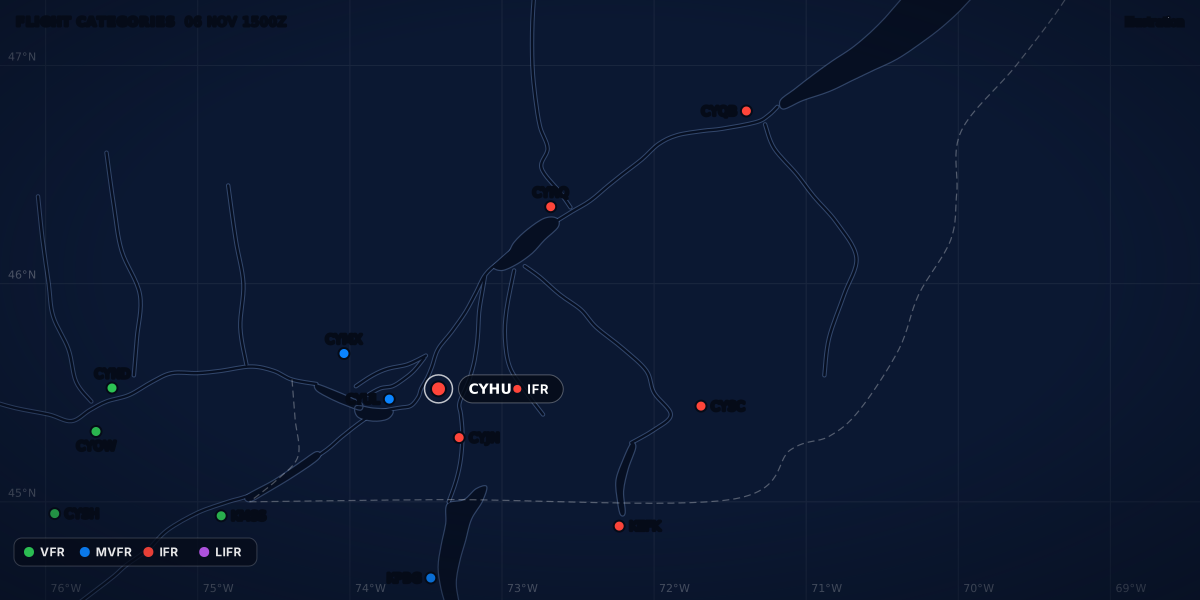
This is a real-format example (constructed, not a real report) for a departure from St-Hubert to Burlington:
The broken layer is at 4,500 ft above the field, and the category is VFR. St-Hubert’s control zone goes “to 2000´ (1900´ AAE)” (DAH 3.5.4-14): 2,000 ft above sea level is 1,900 ft above the aerodrome elevation. So the field is about 100 ft above sea level, and the cloud base is about 4,600 ft ASL.
Southbound, the first two legal altitudes are 4,500 and 6,500 ft. VFR needs at least 500 ft between you and the cloud above you: in Canada, “500 feet vertically” (CARs 602.114(c) and 602.115(b)(iii)), and in the US, “500 feet below” in Class E under 10,000 ft MSL (14 CFR 91.155(a)). The VFR weather minimums guide has the full tables.
| Altitude (ASL) | Height above CYHU | Distance below the base | Result |
|---|---|---|---|
| 4,500 ft (southbound, even + 500) | 4,400 ft | About 100 ft | Not legal: less than 500 ft |
| 6,500 ft (southbound, even + 500) | 6,400 ft | Above the base | Not under the layer. The METAR gives no tops, so 6,500 ft can be in the cloud. Flight above a layer is VFR over the top |
| 3,000 ft or lower | 2,900 ft or less | About 1,600 ft or more | No direction rule: below 3,000 ft above the ground |
| 3,500 ft (northbound, odd + 500) | 3,400 ft | About 1,100 ft | Legal by these numbers |
So on this day, a southbound VFR flight that stays under the layer flies no higher than 3,000 ft above the ground. As far as this report goes, the flight back to St-Hubert can cruise at 3,500 ft. Remember the limits of the example: the METAR gives the base at the station only, the terrain changes the height above the ground, and the airspace around St-Hubert has its own rules (airspace classes).
In ClearMETAR, the Clouds panel of a station draws each reported layer at its height above the field and names the ceiling. The app does not choose a cruising altitude for you.
Cruising altitude is not minimum altitude
The cruising rule tells you which altitude goes with your direction. It never makes a low altitude legal: minimum altitudes still apply (CARs 602.14, 14 CFR 91.119, SERA.5005(f)), and the VFR weather minimums guide sets them side by side.
Next: the airspace classes that decide which minimums apply at your altitude.
Sources
- CARs 602.34: cruising altitudes and cruising flight levels, Justice Laws Website
- TC AIM (TP 14371) 2026-2, RAC 2.2.1, 2.3.1 and Table 2.1, 2.8.2, Transport Canada
- Designated Airspace Handbook (TP 1820E), Issue 324: glossary (NDA, SDA, altimeter setting region, standard pressure region, track) and 3.5.4-14, NAV CANADA
- 14 CFR 91.159: VFR cruising altitude or flight level, eCFR
- 14 CFR 91.179: IFR cruising altitude or flight level, eCFR
- Easy Access Rules for SERA (August 2025): SERA.3110, SERA.5005(d), (f) and (g), SERA.5020(b), SERA.5025(a), Appendix 3, EASA
- AIP France ENR 1.2.7: calage altimétrique et niveaux de croisière (eAIP AIRAC 2026-10-29), SIA (DGAC)
- AIP France ENR 1.7.2.3 and 1.7.5: transition altitude, VFR above FL 195 (eAIP AIRAC 2026-10-29), SIA (DGAC)
- CARs 602.114 and 602.115: minimum visual meteorological conditions for VFR flight, Justice Laws Website
- 14 CFR 91.155: Basic VFR weather minimums, eCFR
- CARs 602.14: minimum altitudes and distances, Justice Laws Website
- 14 CFR 91.119: Minimum safe altitudes: General, eCFR
- Chart Supplement Northeast, 29 OCT 2026 to 24 DEC 2026, p. 325: Patrick Leahy Burlington Intl (KBTV), FAA
- World Magnetic Model (WMM2025), NOAA National Centers for Environmental Information
- Magnetic declination, NOAA National Centers for Environmental Information
Rules checked on
Common questions
Do I use the true or the magnetic course for VFR cruising altitudes?
The magnetic one: CARs 602.34(1)(a), 14 CFR 91.159(a) and SERA Appendix 3 all use the magnetic direction. The exceptions are Canada's Northern Domestic Airspace, where CARs 602.34(1)(b) uses the true track, and the SERA polar areas above 70°, where Appendix 3 uses a grid track.
Does the rule apply below 3,000 ft?
No. It applies only above 3,000 ft above the ground: "more than 3,000 feet AGL" in CARs 602.34(2)(a), "more than 3,000 feet above the surface" in 14 CFR 91.159, and "above 900 m (3000 ft) from the ground or water" in SERA.5005(g).
Do I use my heading or my track?
Your track. CARs 602.34 and SERA Appendix 3 use the track, which is your path over the ground (DAH glossary), and 14 CFR 91.159 uses the magnetic course: none of the three uses the heading.
Why do CVFR flights in Canada fly whole thousands, not thousands plus 500?
TC AIM RAC 2.3.1 Table 2.1 puts CVFR in the "IFR and CVFR" column. Below 18,000 ft ASL, that is odd thousands for tracks from 000° to 179° and even thousands from 180° to 359°.

Let the app do the decoding.
ClearMETAR turns every METAR and TAF into one plain sentence. Free on iPhone.